October 25, 2004
At Sea, N 32o 11' W 177o 12' (35 nm NW of Ensenada, Mexico)
We had a great time at the Baja Ha-Ha kick off party. Linda and I dressed in our old standby costumes, cave man and cave woman, while Phil dressed as a pirate and Joann as a little devil. Linda and I entered the 'scariest monster' group competition (mostly because the people assigning categories couldn't figure out where to put us) and I entered the 'most buff' competition by myself. Although I was never a threat to win, I did manage to get a consolation prize.
We left the party after all the prizes had been awarded and we'd had our fill of the atmosphere. We met up with Anita and Ron (http://libertycall2.blogspot.com) to return their car (thanks again for loaning it to us you guys!) and returned to the boat to get to bed early.
This morning, the day of our departure, dawned grey and drizzly. Not the best conditions for sailing to Mexico! We resigned ourselves to the situation though and set about taking care of last minute business. First I had to call my broker and sell some Cisco stock. Two weeks in San Diego and we were just about broke! Then we took NAKIA over to the San Diego Yacht Club and tied to the dinghy dock so we could walk over to Downwind Marine and wait for FedEx to deliver our absentee ballots. We only had to wait around for 45 minutes or so and hurriedly filled in the ballots and dropped them in the mail.
Then it was off to the starting line. Having been in such a hurry to get the ballots mailed we were surprised to make the starting area a little early. No problem however, the Baja Ha-Ha committee doesn't keep track if someone is over early. We did our best to stay behind the line until the appointed moment and had pretty good position when the gun went off.
Off like a herd of turtles, we sailed away from San Diego.
John, Linda, Phil, and Joann
|
|
Tuesday, October 26, 2004
First Day Out
October 26, 2004
At Sea, N 30o 41' W 116o 50' (40 nm west of Punta Camalu)
That's right, Punta Camalu. Frankly I'm not sure if that's even a town, but I have to put something down for where we are :-) This stretch of the Baja coast is very lightly populated.
We caught two large Bonito yesterday afternoon on our way through the Coronado Islands. These were much larger then the ones we kept from Santa Cruz Island and were very easy to clean thanks to our new fillet knife (thanks Sharon!).
We have sailed about half the time, the wind died shortly after sunset last night. Having all these boats around us has taken some getting used to. There are 142 boats that started the Ha-Ha and it seemed like we had 10-15 close around us most of the night last night. Once the sun rose this morning the ranks had spread out a little more and we don't feel so confined.
I put out the fishing lure early this morning and later Joann noticed that we had a fish. She pulled in a small Albacore, as she did one of the Bonito yesterday, and Phil cleaned it. Joann is turning out to be NAKIA's good luck charm; she's pulled in two of our three fish and we always seem to sail fastest during her watch.
We're heading a little further offshore in anticipation of a cold front coming through tomorrow night. Hopefully it won't amount to much as promised by the rally chairman Richard (also known as the Grand Poobah).
More tomorrow, we have at least two more days to go before our first stop at Turtle Bay.
John, Linda, Phil, and Joann
At Sea, N 30o 41' W 116o 50' (40 nm west of Punta Camalu)
That's right, Punta Camalu. Frankly I'm not sure if that's even a town, but I have to put something down for where we are :-) This stretch of the Baja coast is very lightly populated.
We caught two large Bonito yesterday afternoon on our way through the Coronado Islands. These were much larger then the ones we kept from Santa Cruz Island and were very easy to clean thanks to our new fillet knife (thanks Sharon!).
We have sailed about half the time, the wind died shortly after sunset last night. Having all these boats around us has taken some getting used to. There are 142 boats that started the Ha-Ha and it seemed like we had 10-15 close around us most of the night last night. Once the sun rose this morning the ranks had spread out a little more and we don't feel so confined.
I put out the fishing lure early this morning and later Joann noticed that we had a fish. She pulled in a small Albacore, as she did one of the Bonito yesterday, and Phil cleaned it. Joann is turning out to be NAKIA's good luck charm; she's pulled in two of our three fish and we always seem to sail fastest during her watch.
We're heading a little further offshore in anticipation of a cold front coming through tomorrow night. Hopefully it won't amount to much as promised by the rally chairman Richard (also known as the Grand Poobah).
More tomorrow, we have at least two more days to go before our first stop at Turtle Bay.
John, Linda, Phil, and Joann
Saturday, October 23, 2004
Get Ready, Get Set ...
October 23, 2004
San Diego, CA (N 32o 42' W 117o 14')
After almost two weeks in San Diego we're getting ready to take off to Mexico with the Baja Ha-Ha. We've bought so many provisions that we can barely see the water line any more, loaded up on enough beer to float a battle ship, bought Mexican fishing licenses, a new spinnaker, got our tourist cards and, most importantly, picked up our great crew Phil and Joann.
Unfortunately, we didn't see much of San Diego that wasn't boating related. The world famous zoo, Sea World, Old Town, and the Gas Lamp district will have to wait until some other visit. I did have time to get a new shore side hobby though: driving around town looking for unsecured wireless networks to connect my lap top to so we can access the internet. Who needs an internet cafe?!
We went out for a short sail today with Phil, Joann, Alicia, and Doug. It was a little cool but we needed the chance to fly the new spinnaker and are very satisfied with it. The old spinnaker has already been successfully sold on eBay and is on its way to its new owner. Doug wanted to catch a tuna, so we towed the lure around for a while and managed to catch a Bonito which Doug took to a house warming party. I think we got the better half of the deal though since Doug had brought us grapes freshly picked from the fields of Delano, CA which were better than anything you could get from a grocery store.
Tomorrow is the big Baja Ha-Ha kick off party and Monday we take off to points south of the border. We can hardly wait!
John, Linda, Phil, and Joann
San Diego, CA (N 32o 42' W 117o 14')
After almost two weeks in San Diego we're getting ready to take off to Mexico with the Baja Ha-Ha. We've bought so many provisions that we can barely see the water line any more, loaded up on enough beer to float a battle ship, bought Mexican fishing licenses, a new spinnaker, got our tourist cards and, most importantly, picked up our great crew Phil and Joann.
Unfortunately, we didn't see much of San Diego that wasn't boating related. The world famous zoo, Sea World, Old Town, and the Gas Lamp district will have to wait until some other visit. I did have time to get a new shore side hobby though: driving around town looking for unsecured wireless networks to connect my lap top to so we can access the internet. Who needs an internet cafe?!
We went out for a short sail today with Phil, Joann, Alicia, and Doug. It was a little cool but we needed the chance to fly the new spinnaker and are very satisfied with it. The old spinnaker has already been successfully sold on eBay and is on its way to its new owner. Doug wanted to catch a tuna, so we towed the lure around for a while and managed to catch a Bonito which Doug took to a house warming party. I think we got the better half of the deal though since Doug had brought us grapes freshly picked from the fields of Delano, CA which were better than anything you could get from a grocery store.
Tomorrow is the big Baja Ha-Ha kick off party and Monday we take off to points south of the border. We can hardly wait!
John, Linda, Phil, and Joann


Friday, October 15, 2004
Celebrity Sighting!
We moved from the nice little anchorage at Glorietta Bay to our slip at the public dock yesterday. We'll be here until the start of the Baja Ha-Ha. It's such a relief to know that we won't have to ping pong around until the start. Obviously we're not the only ones with a plan. It's possible to stay 10 nights at the public dock. This morning at least 6 other Ha-Ha boats pulled in to the public dock area and there isn't an empty slip available. The start is 10 nights away.
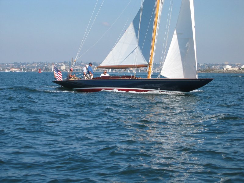
As for the celebrity, we were in the dinghy near the San Diego Yacht Club and in front of us was a beautiful old sailboat, obviously restored. It was under sail and in the process of taking down the jib. They completed this maneuver and as we got closer I changed course to let them continue on their way to the SDYC dock. As they passed we were only about 15 feet apart and I looked in to the cockpit to see none other than Dennis Conner at the tiller! After we passed I asked Linda if she knew who that was and she said it looked like Dennis Conner with a big gut. (Well he is a little older and heavier then he was in his AC days...)
We're in our final preparations for the rally. I ordered a new spinnaker which is larger then the old one and am trying to sell the old one on Ebay. We need to get this boat to move! (They call it a rally, but we all know it's really a race.)
John and Linda
As for the celebrity, we were in the dinghy near the San Diego Yacht Club and in front of us was a beautiful old sailboat, obviously restored. It was under sail and in the process of taking down the jib. They completed this maneuver and as we got closer I changed course to let them continue on their way to the SDYC dock. As they passed we were only about 15 feet apart and I looked in to the cockpit to see none other than Dennis Conner at the tiller! After we passed I asked Linda if she knew who that was and she said it looked like Dennis Conner with a big gut. (Well he is a little older and heavier then he was in his AC days...)
We're in our final preparations for the rally. I ordered a new spinnaker which is larger then the old one and am trying to sell the old one on Ebay. We need to get this boat to move! (They call it a rally, but we all know it's really a race.)
John and Linda
Wednesday, October 13, 2004
Duck! Here comes another helocopter!
October 12, 2004
Glorietta Bay, San Diego (N 32o 40' W 117o 10')
We didn't have much time to enjoy the Dana Point Yacht Club Sunday, we were really only interested in a good night's sleep. We slept very well indeed, for the first time since arriving at Catalina several days before. So well did we sleep that we had no trouble getting up bright and early Monday morning with the intention of sailing the 24 nautical miles to Oceanside. The wind was light and out of the south, so we had to beat. This wasn't working out very well especially since we had the small jib up, but we did our best.
The trip was made more interesting by a Navy ship which had positioned itself directly south of us. At first it looked like they were conducting firing exercises, shooting at a towed target. This was hard to believe, so close to shore, but it was clear there was an object following behind the ship and every once in a while large amounts of spray would fly into the air accompanied by a noise that sounded like an airplane propeller. Finally, when we got closer we saw that the sound was coming from the 'target', which turned out to be a huge hover craft. The spray wasn't bullets hitting the sea but the hover craft hovering. At one point the craft passed astern of us and ran right up on the beach sending sand and dust every where. What a mess! Can you imagine what the deck of that thing looked like after being showered with salt spray for hours then dusted with beach sand?
Our sailing wasn't progressing very well during all this so we changed jibs to the 115%. This was only the second time we've done this on NAKIA underway (since getting roller furling) and it went much better this time.
Finally around 1600 we pulled into Oceanside. We were kind of worried about getting a spot at the yacht club since a transient slip in the marina would have cost us $40, so we were relieved to find the Yacht Club guest dock unoccupied. We went up and signed in and were immediately invited to Monday Night football at the club. Potluck sides and hot dogs sounded great to us so we accepted the invitation and hit the showers to wash off the sweat from all that sailing.
The Oceanside Yacht Club membership turned out to be some of the most friendly people we've met on our trip down the coast. They put out a great spread for the football game and really made us feel welcome. It would have been nice to spend a few nights and explore this little town (right next door to Camp Pendleton) but we had a reservation in an anchorage in San Diego and wanted to take full advantage of it so we departed Oceanside at first light for San Diego.
The closer we got to San Diego the busier the sea and sky became. It started off the coast of La Jolla where navy fighters would pass overhead coming and going from Miramar. Then as we rounded Point Loma it seemed like there was a constant buzz of helicopters taking off from North Island and flying offshore, circling back and then buzzing over us again. I told Linda I'm not sure I want to stay in San Diego for two weeks if it's going to be like this!
We checked in with the Harbor Police and made our way down the bay to Glorietta Bay to drop anchor. It's a nice snug spot, with quite a few boats, but well protected. We're within sight of the Coronado Hotel and look out the cockpit onto a golf course. We're not complaining.
Glorietta Bay, San Diego (N 32o 40' W 117o 10')
We didn't have much time to enjoy the Dana Point Yacht Club Sunday, we were really only interested in a good night's sleep. We slept very well indeed, for the first time since arriving at Catalina several days before. So well did we sleep that we had no trouble getting up bright and early Monday morning with the intention of sailing the 24 nautical miles to Oceanside. The wind was light and out of the south, so we had to beat. This wasn't working out very well especially since we had the small jib up, but we did our best.
The trip was made more interesting by a Navy ship which had positioned itself directly south of us. At first it looked like they were conducting firing exercises, shooting at a towed target. This was hard to believe, so close to shore, but it was clear there was an object following behind the ship and every once in a while large amounts of spray would fly into the air accompanied by a noise that sounded like an airplane propeller. Finally, when we got closer we saw that the sound was coming from the 'target', which turned out to be a huge hover craft. The spray wasn't bullets hitting the sea but the hover craft hovering. At one point the craft passed astern of us and ran right up on the beach sending sand and dust every where. What a mess! Can you imagine what the deck of that thing looked like after being showered with salt spray for hours then dusted with beach sand?
Our sailing wasn't progressing very well during all this so we changed jibs to the 115%. This was only the second time we've done this on NAKIA underway (since getting roller furling) and it went much better this time.
Finally around 1600 we pulled into Oceanside. We were kind of worried about getting a spot at the yacht club since a transient slip in the marina would have cost us $40, so we were relieved to find the Yacht Club guest dock unoccupied. We went up and signed in and were immediately invited to Monday Night football at the club. Potluck sides and hot dogs sounded great to us so we accepted the invitation and hit the showers to wash off the sweat from all that sailing.
The Oceanside Yacht Club membership turned out to be some of the most friendly people we've met on our trip down the coast. They put out a great spread for the football game and really made us feel welcome. It would have been nice to spend a few nights and explore this little town (right next door to Camp Pendleton) but we had a reservation in an anchorage in San Diego and wanted to take full advantage of it so we departed Oceanside at first light for San Diego.
The closer we got to San Diego the busier the sea and sky became. It started off the coast of La Jolla where navy fighters would pass overhead coming and going from Miramar. Then as we rounded Point Loma it seemed like there was a constant buzz of helicopters taking off from North Island and flying offshore, circling back and then buzzing over us again. I told Linda I'm not sure I want to stay in San Diego for two weeks if it's going to be like this!
We checked in with the Harbor Police and made our way down the bay to Glorietta Bay to drop anchor. It's a nice snug spot, with quite a few boats, but well protected. We're within sight of the Coronado Hotel and look out the cockpit onto a golf course. We're not complaining.
Sunday, October 10, 2004
Wild Night
October 10, 2004
Dana Point Yacht Club, Dana Point (N 33o 27' W 117o 42')
I think we pretty much got our fill of Catalina. I mentioned before about how rolly the anchorage was, previous nights were nothing compared to what we went through last night. If we didn't have the rocker stopper I'm sure we would have both been thrown right out of bed.
It wasn't all bad, we had a nice hike yesterday in the hills and went to the bar last night with Tom and Kate, a Canadian couple who are taking a year off to cruise the Pacific. There was a DJ and such a great mix of people that we ended up staying until almost midnight.
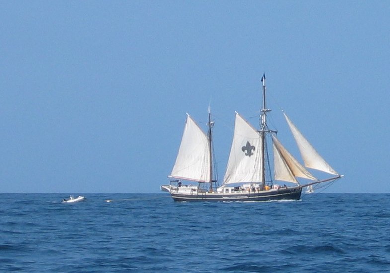
We woke early this morning (as if we really slept last night to begin with) to make the 40 mile trip over to Dana Point. We arrived at Dana Point this afternoon after a long motor boat trip. Not much happened on the way over except we saw several Risso's dolphins and I caught a few bonito on the way - but none of the yellow tail we heard fishermen talking about on the radio. One other highlight of the trip was seeing what I think was the Argus, a Sea Scout boat that a freind sailed when he was in Scouts. I have a picture which I'll post to the blog the next chance I get. They were returning from Avalon, bound for Long Beach (I think).
We were lucky enough to find a few feet of dock space to tie up to at the Dana Point Yacht Club. We'll be here a couple nights and then head down to San Diego to face the mooring situation down there.
John and Linda
Dana Point Yacht Club, Dana Point (N 33o 27' W 117o 42')
I think we pretty much got our fill of Catalina. I mentioned before about how rolly the anchorage was, previous nights were nothing compared to what we went through last night. If we didn't have the rocker stopper I'm sure we would have both been thrown right out of bed.
It wasn't all bad, we had a nice hike yesterday in the hills and went to the bar last night with Tom and Kate, a Canadian couple who are taking a year off to cruise the Pacific. There was a DJ and such a great mix of people that we ended up staying until almost midnight.
We woke early this morning (as if we really slept last night to begin with) to make the 40 mile trip over to Dana Point. We arrived at Dana Point this afternoon after a long motor boat trip. Not much happened on the way over except we saw several Risso's dolphins and I caught a few bonito on the way - but none of the yellow tail we heard fishermen talking about on the radio. One other highlight of the trip was seeing what I think was the Argus, a Sea Scout boat that a freind sailed when he was in Scouts. I have a picture which I'll post to the blog the next chance I get. They were returning from Avalon, bound for Long Beach (I think).
We were lucky enough to find a few feet of dock space to tie up to at the Dana Point Yacht Club. We'll be here a couple nights and then head down to San Diego to face the mooring situation down there.
John and Linda
Thursday, October 07, 2004
Catalina
October 7, 2004
Isthmus Cove, Catalina Island (N 33o 26' W 118o 29')
We spent two nights at Little Scorpion after leaving Santa Barbara. We took one day and went ashore and hiked the bluffs over the east end of the island. The views were incredible and we had no problem with the 8 mile round trip this time. The terrain was easier and we seemed to be getting our lungs back.
One thing we're not getting used to is these rolly anchorages! Canada was so nice - we could walk around the boat without having to hold on. Now the boat is constantly in motion, it's almost like being under sail sometimes. We've set out the rocker stopper every night we've been at anchor and it sure helps, but even with it out the boat rolls and pitches quite a bit.
We made the long trip to Catalina from Santa Cruz yesterday. We motored all the way. We could have sailed the last few hours but as we left Santa Cruz a bird landed on deck (it must have been disoriented in the fog) and we couldn't set sail for fear of scaring it into flight. I tried to convince Linda that if it was really tired it would come back to NAKIA even after being frightened off, but she was not willing to take the chance. Oh well, it only cost us a few gallons of fuel to get the bird safely to Catalina. Hopefully we didn't introduce some non-native species that's going to have to be eradicated later.
I started out this morning by throwing a fishing lure around the anchorage. Mostly I was just bored, not trying to catch anything to keep. I hooked a small bonito, which didn't fight very much, and I let him go (I'm using barbless hooks now to make the 'letting go' easier). I cast out again and hooked something else which I was sure was a snag but when I got it up to the boat it turned out to be a little California Halibut! It was only a couple of pounds, but filleted into about 3/4 of a pound of meat, perfect for Linda and I. It's really fun to catch something good when the most you're hoping for is a little entertainment.
This afternoon we walked around the little town of Two Harbors to get some exercise. Or at least that's our excuse for getting ice cream sandwiches after the walk. We also took showers which for me turned out to be less then satisfying. $.50 for a three minute shower that was cold, then warm, then cold, then tepid, then warm. I would have rather had a hot shower and paid $1. (Linda reports her $.75 shower was plenty hot the whole time.)
We're going to stick around here for a few days since we don't have reservations in San Diego until the 12th. Not sure what we're going to do with all that time, but I'm sure we'll find something. At least there's ice cream close by.
John and Linda
Isthmus Cove, Catalina Island (N 33o 26' W 118o 29')
We spent two nights at Little Scorpion after leaving Santa Barbara. We took one day and went ashore and hiked the bluffs over the east end of the island. The views were incredible and we had no problem with the 8 mile round trip this time. The terrain was easier and we seemed to be getting our lungs back.
One thing we're not getting used to is these rolly anchorages! Canada was so nice - we could walk around the boat without having to hold on. Now the boat is constantly in motion, it's almost like being under sail sometimes. We've set out the rocker stopper every night we've been at anchor and it sure helps, but even with it out the boat rolls and pitches quite a bit.
We made the long trip to Catalina from Santa Cruz yesterday. We motored all the way. We could have sailed the last few hours but as we left Santa Cruz a bird landed on deck (it must have been disoriented in the fog) and we couldn't set sail for fear of scaring it into flight. I tried to convince Linda that if it was really tired it would come back to NAKIA even after being frightened off, but she was not willing to take the chance. Oh well, it only cost us a few gallons of fuel to get the bird safely to Catalina. Hopefully we didn't introduce some non-native species that's going to have to be eradicated later.
I started out this morning by throwing a fishing lure around the anchorage. Mostly I was just bored, not trying to catch anything to keep. I hooked a small bonito, which didn't fight very much, and I let him go (I'm using barbless hooks now to make the 'letting go' easier). I cast out again and hooked something else which I was sure was a snag but when I got it up to the boat it turned out to be a little California Halibut! It was only a couple of pounds, but filleted into about 3/4 of a pound of meat, perfect for Linda and I. It's really fun to catch something good when the most you're hoping for is a little entertainment.
This afternoon we walked around the little town of Two Harbors to get some exercise. Or at least that's our excuse for getting ice cream sandwiches after the walk. We also took showers which for me turned out to be less then satisfying. $.50 for a three minute shower that was cold, then warm, then cold, then tepid, then warm. I would have rather had a hot shower and paid $1. (Linda reports her $.75 shower was plenty hot the whole time.)
We're going to stick around here for a few days since we don't have reservations in San Diego until the 12th. Not sure what we're going to do with all that time, but I'm sure we'll find something. At least there's ice cream close by.
John and Linda
Monday, October 04, 2004
Farewell to Sharon
October 2, 2004
Santa Barbara (N 34o 24' W 119o 41')
On Thursday we moved from Pelican Bay to Little Scorpion anchorage. Little Scorpion is on the east end of Santa Cruz Island and when we arrived there were two other boats in the anchorage. The guide book says to get as close to the two tall rocks at the north end as possible for shelter. There's definitely a trade off. The rocks are covered by roosting brown pelicans. Get too close to the rocks and the odor is quite strong. We got a great spot and only had to deal with the fumes until the wind came up a little.
We were invited to happy hour on Sol Mates and had a great time talking to Stan and MJ, along with Dennis and Cathy from Pinecone. MJ treated us to bread sticks which she made fresh herself, yummy!
I tried fishing off the point. I was going after sea bass again, under strict orders from the crew not to bring back any more bonito. No success. It's very frustrating to have caught those two near Fry's anchorage so easily/quickly and now I can't seem to find them again.
Friday morning we started out for Santa Barbara at 0900. We soon set sail out in the channel and were treated to the site of hundreds of Pacific White Sided Dolphin. Most of them seemed to be feeding so didn't come over and play in NAKIA's bow wave, but several did so Linda and Sharon had a great time cheering their antics from the bow sprit.
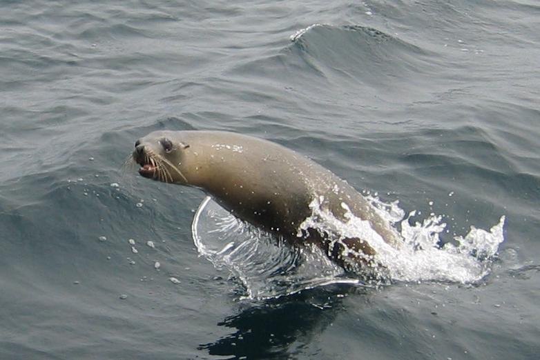
As we got closer to Santa Barbara a sea lion started to trail NAKIA. It would swim from one side of the boat to the other, coming as close as 10 feet away, jumping out of the water and then swimming right under the rudder. This went on for over half an hour. We all whooped and applauded his highest jumps and this seemed to get him going even more.
Santa Barbara Marina is very busy as we got the last guest slip in the marina. Many of the transients are doing the Ha-Ha. It's great to get to know a few people we'll be doing the rally with, though it makes it hard to get down the dock when you stop to chat with every tenth person. One couple in particular, Gene and Pat from Chalet Mer, were very kind and offered us a ride in their rental car to West Marine and the grocery store. This made running errands very quick and pain free not having to carry everything back to the boat on foot.
Saturday we had breakfast at the original Sambo's (yes, that Sambo's - 1957!) and then took Sharon to the Amtrak station for her ride home. We were both sorry to see her go but are also expecting to see her turn up again on someone else's boat in San Diego and/or on the Ha-Ha.
We'll be back out to Santa Cruz island on Monday (more errands on Sunday) and then down to Catalina. We'll probably be in San Diego earlier than we had anticipated but with all the Ha-Ha boats going down, getting a slip is proving very difficult. Hopefully getting there early will help in that department.
John and Linda
Santa Barbara (N 34o 24' W 119o 41')
On Thursday we moved from Pelican Bay to Little Scorpion anchorage. Little Scorpion is on the east end of Santa Cruz Island and when we arrived there were two other boats in the anchorage. The guide book says to get as close to the two tall rocks at the north end as possible for shelter. There's definitely a trade off. The rocks are covered by roosting brown pelicans. Get too close to the rocks and the odor is quite strong. We got a great spot and only had to deal with the fumes until the wind came up a little.
We were invited to happy hour on Sol Mates and had a great time talking to Stan and MJ, along with Dennis and Cathy from Pinecone. MJ treated us to bread sticks which she made fresh herself, yummy!
I tried fishing off the point. I was going after sea bass again, under strict orders from the crew not to bring back any more bonito. No success. It's very frustrating to have caught those two near Fry's anchorage so easily/quickly and now I can't seem to find them again.
Friday morning we started out for Santa Barbara at 0900. We soon set sail out in the channel and were treated to the site of hundreds of Pacific White Sided Dolphin. Most of them seemed to be feeding so didn't come over and play in NAKIA's bow wave, but several did so Linda and Sharon had a great time cheering their antics from the bow sprit.
As we got closer to Santa Barbara a sea lion started to trail NAKIA. It would swim from one side of the boat to the other, coming as close as 10 feet away, jumping out of the water and then swimming right under the rudder. This went on for over half an hour. We all whooped and applauded his highest jumps and this seemed to get him going even more.
Santa Barbara Marina is very busy as we got the last guest slip in the marina. Many of the transients are doing the Ha-Ha. It's great to get to know a few people we'll be doing the rally with, though it makes it hard to get down the dock when you stop to chat with every tenth person. One couple in particular, Gene and Pat from Chalet Mer, were very kind and offered us a ride in their rental car to West Marine and the grocery store. This made running errands very quick and pain free not having to carry everything back to the boat on foot.
Saturday we had breakfast at the original Sambo's (yes, that Sambo's - 1957!) and then took Sharon to the Amtrak station for her ride home. We were both sorry to see her go but are also expecting to see her turn up again on someone else's boat in San Diego and/or on the Ha-Ha.
We'll be back out to Santa Cruz island on Monday (more errands on Sunday) and then down to Catalina. We'll probably be in San Diego earlier than we had anticipated but with all the Ha-Ha boats going down, getting a slip is proving very difficult. Hopefully getting there early will help in that department.
John and Linda
Sunday, October 03, 2004

Wednesday, September 29, 2004
Bonita Bonito
September 29, 2004
Pelican Bay, Santa Cruz Island (N 34o 02' W 119o 42')
We woke this morning to a wonderful day. Doubly wonderful considering the night before was very uncomfortable due to a lot of rolling.
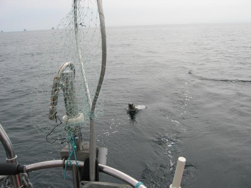
The fish fountain was going big time in the light of the new day. (Fish Fountain is the name we give to the sound that small fish make when they jump and splash around the boat, it sounds like a fountain.) Sharon and I figured the reason the small fish were jumping so much was because there were larger fish chasing them. I figured I'd find out for sure by putting a lure on and casting it out. Sure enough after about 10 casts I hooked into a fun little fighting fish. When I finally got it up to the boat I was surprised that the fighter was only a 12 inch bonito. We just had to keep it though, so I kept the fish on the line while Sharon got the net out of the lazarette. Unfortunately, before she could get the net under the fish it got off. But, encouraged by a little success, I continued fishing and soon had a larger one on. Sharon got this one netted and we began making plans on how to cook the little wonder. I kept casting and kept catching fish, letting them go until we had another nice one. Sharon cleaned them nicely (did I mention how wonderful it is not to have to catch AND clean fish) and I put the fillets into the fridge for dinner.
Then we took a short dinghy ride exploring the shore around the anchorage. There was one small sea cave that we went all the way into, the surge being low, ducking our heads to keep from banging them on the low ceiling. We also took the dinghy under a rock arch which was pretty cool.
After the exploration trip I was sent fishing again. I made the mistake of telling Sharon that a fisherman I spoke to yesterday mentioned fishing for halibut. Sharon insisted that I go catch a halibut for dinner. I set out in the dinghy and rigged a lure when I arrived where the fisherman had told me halibut might be caught. The thing was, I liked catching bonito. So instead of rigging a halibut lure I rigged the spoon that had caught bonito in the anchorage. I must have caught and released 10-15 fish in the course of an hour. When I finally decided to fish for halibut I found it far too boring, all fishing and no catching, so I returned to NAKIA empty handed.
For the second night in a row we had happy hour on NAKIA. We invited Charlie and Grania from Zester and Bill and Diana from Diana B. over and had a great time. After they left, we put the bonito on the BBQ and ate it with some green beans and couscous. We liked the flavor well enough but all agreed we'd rather have calico sea bass.
As the sun set the wind died and the rolling started. This time I decided to put out our 'rocker-stopper' to see if it would help and the consensus is that it helps a great deal. The motion of the boat is more 'jerky,' but we don't have the incessant rolling that we had last night. We may actually be able to sleep.
Tomorrow we're moving to the east end of the island, which has become a national park since the last time we were here, and are looking forward to a walk on the beach there.
Pelican Bay, Santa Cruz Island (N 34o 02' W 119o 42')
We woke this morning to a wonderful day. Doubly wonderful considering the night before was very uncomfortable due to a lot of rolling.
The fish fountain was going big time in the light of the new day. (Fish Fountain is the name we give to the sound that small fish make when they jump and splash around the boat, it sounds like a fountain.) Sharon and I figured the reason the small fish were jumping so much was because there were larger fish chasing them. I figured I'd find out for sure by putting a lure on and casting it out. Sure enough after about 10 casts I hooked into a fun little fighting fish. When I finally got it up to the boat I was surprised that the fighter was only a 12 inch bonito. We just had to keep it though, so I kept the fish on the line while Sharon got the net out of the lazarette. Unfortunately, before she could get the net under the fish it got off. But, encouraged by a little success, I continued fishing and soon had a larger one on. Sharon got this one netted and we began making plans on how to cook the little wonder. I kept casting and kept catching fish, letting them go until we had another nice one. Sharon cleaned them nicely (did I mention how wonderful it is not to have to catch AND clean fish) and I put the fillets into the fridge for dinner.
Then we took a short dinghy ride exploring the shore around the anchorage. There was one small sea cave that we went all the way into, the surge being low, ducking our heads to keep from banging them on the low ceiling. We also took the dinghy under a rock arch which was pretty cool.
After the exploration trip I was sent fishing again. I made the mistake of telling Sharon that a fisherman I spoke to yesterday mentioned fishing for halibut. Sharon insisted that I go catch a halibut for dinner. I set out in the dinghy and rigged a lure when I arrived where the fisherman had told me halibut might be caught. The thing was, I liked catching bonito. So instead of rigging a halibut lure I rigged the spoon that had caught bonito in the anchorage. I must have caught and released 10-15 fish in the course of an hour. When I finally decided to fish for halibut I found it far too boring, all fishing and no catching, so I returned to NAKIA empty handed.
For the second night in a row we had happy hour on NAKIA. We invited Charlie and Grania from Zester and Bill and Diana from Diana B. over and had a great time. After they left, we put the bonito on the BBQ and ate it with some green beans and couscous. We liked the flavor well enough but all agreed we'd rather have calico sea bass.
As the sun set the wind died and the rolling started. This time I decided to put out our 'rocker-stopper' to see if it would help and the consensus is that it helps a great deal. The motion of the boat is more 'jerky,' but we don't have the incessant rolling that we had last night. We may actually be able to sleep.
Tomorrow we're moving to the east end of the island, which has become a national park since the last time we were here, and are looking forward to a walk on the beach there.
Tuesday, September 28, 2004
Oh my feet!
September 28, 2004
Pelican Bay, Santa Cruz Island N 34o 02' W 119o 42')
We were about to pull up anchor from Fry's Harbor when Linda noticed the shifting lever wasn't working quite right. A quick glance in the engine compartment confirmed that the shifting lever on the transmission was not in the right position for Forward/Neutral/Reverse. I quickly dismantled the binnacle and found the problem, two loose screws on the shifter cable. A little locktite and we were soon back in business.
Fortunately, this little delay timed our arrival in Pelican Bay after several boats had departed. If we had been able to leave when we first wanted we would not have gotten as good a spot as we did.
We put the dinghy in the water, had lunch and decided to go for a hike before showers and dinner. We made our way to shore, getting splashed only a few times by waves breaking on the dinghy, and landed on a gravel beach around the corner from Pelican Bay.
That was at about 1430. We spent the next two and a half hours hiking on the rugged hills of Santa Cruz Island, following the trail out to Prisoner's Cove. It wasn't very hot, but it was quite dry, and we were all pretty dusty by the time we got back to the dinghy.
According to the sign at Prisoner's Cove it's an 8 mile round trip, way longer then we've hiked all summer, and much more than we were prepared to handle. Showers after the hike sure felt good and we all had second helpings of the huge pasta dish I made for dinner.
Tomorrow we plan on hanging out and reading. Maybe I'll do a project. But then again maybe I won't. I'd like to rest my feet.
Pelican Bay, Santa Cruz Island N 34o 02' W 119o 42')
We were about to pull up anchor from Fry's Harbor when Linda noticed the shifting lever wasn't working quite right. A quick glance in the engine compartment confirmed that the shifting lever on the transmission was not in the right position for Forward/Neutral/Reverse. I quickly dismantled the binnacle and found the problem, two loose screws on the shifter cable. A little locktite and we were soon back in business.
Fortunately, this little delay timed our arrival in Pelican Bay after several boats had departed. If we had been able to leave when we first wanted we would not have gotten as good a spot as we did.
We put the dinghy in the water, had lunch and decided to go for a hike before showers and dinner. We made our way to shore, getting splashed only a few times by waves breaking on the dinghy, and landed on a gravel beach around the corner from Pelican Bay.
That was at about 1430. We spent the next two and a half hours hiking on the rugged hills of Santa Cruz Island, following the trail out to Prisoner's Cove. It wasn't very hot, but it was quite dry, and we were all pretty dusty by the time we got back to the dinghy.
According to the sign at Prisoner's Cove it's an 8 mile round trip, way longer then we've hiked all summer, and much more than we were prepared to handle. Showers after the hike sure felt good and we all had second helpings of the huge pasta dish I made for dinner.
Tomorrow we plan on hanging out and reading. Maybe I'll do a project. But then again maybe I won't. I'd like to rest my feet.
Monday, September 27, 2004
Pigs and Caves
September 27, 2004
Fry's Harbor, Santa Cruz Island (34o 03' N 119o 45' W)
We spent three hours this morning exploring the Northwest shore of Santa Cruz Island by dinghy. There are no overnight anchorages on that end of the island so we had to make the run all the way from Fry's. Linda and Sharon went all out and put on full foul weather gear for the trip. I think they got wetter from the sweat than from the spray.
On the way out we stopped at Cueva Valdes anchorage and spotted a wild pig on the beach. We let the swell drift us in toward shore to get a closer look, and we felt like we were on some kind of Sunday evening nature show. I provided the whispered Marlin Perkins voice over, "These small animals search for food along the high tide line ..."
We made our way up to the Painted Cave and rowed in, letting the swell push us in slowly. The cave has two chambers, an outer one which is pretty high and an inner one which is separated from the outer chamber by a low arch. We sat at the entrance to the arch for 5-10 minutes, listening to the sound of the waves crashing in the inner chamber and watching the swell reduce the head room in the arch to 5 feet. In the end we decided it wasn't worth risking damaging the dinghy to explore the inner chamber so we just sat in the outer and listened to the thunder-like crashing of the waves inside.
On the way back from the Painted Cave we stopped at several blow holes on the shore. The largest is inside a sea cave and shoots spay and mist 20-30 feet out of the cave when a good swell hits it. It was loud too, we all thought it sounded like a dragon snoring inside the cave. We also stopped at a large rock arch and dared to take the dinghy under it in the swell. Not that big a deal really, but it sounds cool.
Back at the boat we had quesadillas for lunch and then I took the dinghy out to go fishing. Sharon said that if I caught anything she would clean it which made me want to catch something even more. It was pretty windy, which made bottom fishing hard, and I managed to lose my first lure after snagging it on the bottom. I tied on a different lure and cast it out a bit and soon had a good size calico sea bass in the boat. A few casts later and I pulled in a second larger fish. We're having fish tacos for dinner tonight!
Tomorrow we plan on moving to Pelican Bay where there are good hiking trails.
John, Linda and Sharon
Fry's Harbor, Santa Cruz Island (34o 03' N 119o 45' W)
We spent three hours this morning exploring the Northwest shore of Santa Cruz Island by dinghy. There are no overnight anchorages on that end of the island so we had to make the run all the way from Fry's. Linda and Sharon went all out and put on full foul weather gear for the trip. I think they got wetter from the sweat than from the spray.
On the way out we stopped at Cueva Valdes anchorage and spotted a wild pig on the beach. We let the swell drift us in toward shore to get a closer look, and we felt like we were on some kind of Sunday evening nature show. I provided the whispered Marlin Perkins voice over, "These small animals search for food along the high tide line ..."
We made our way up to the Painted Cave and rowed in, letting the swell push us in slowly. The cave has two chambers, an outer one which is pretty high and an inner one which is separated from the outer chamber by a low arch. We sat at the entrance to the arch for 5-10 minutes, listening to the sound of the waves crashing in the inner chamber and watching the swell reduce the head room in the arch to 5 feet. In the end we decided it wasn't worth risking damaging the dinghy to explore the inner chamber so we just sat in the outer and listened to the thunder-like crashing of the waves inside.
On the way back from the Painted Cave we stopped at several blow holes on the shore. The largest is inside a sea cave and shoots spay and mist 20-30 feet out of the cave when a good swell hits it. It was loud too, we all thought it sounded like a dragon snoring inside the cave. We also stopped at a large rock arch and dared to take the dinghy under it in the swell. Not that big a deal really, but it sounds cool.
Back at the boat we had quesadillas for lunch and then I took the dinghy out to go fishing. Sharon said that if I caught anything she would clean it which made me want to catch something even more. It was pretty windy, which made bottom fishing hard, and I managed to lose my first lure after snagging it on the bottom. I tied on a different lure and cast it out a bit and soon had a good size calico sea bass in the boat. A few casts later and I pulled in a second larger fish. We're having fish tacos for dinner tonight!
Tomorrow we plan on moving to Pelican Bay where there are good hiking trails.
John, Linda and Sharon
Sunday, September 26, 2004
Pt. Conception Rodeo
September 26, 2004
Fry's Harbor (34o 03' N 119o 45' W)
We left Morro Bay yesterday afternoon after spending the morning running errands. Sharon found a garage sale but didn't feel like sleeping with the wine rack she found so decided not to buy it. I found the reported 'coldest toilet seat on the west coast' and decided that it looked very cold, but was not willing to test to find out.
The trip over the bar was uneventful and we were able to set sail after motoring a few miles out from Morro Bay.
I checked the weather reports from Pt. Arguello frequently. I'm not sure why I do this since it's not like we're going to turn around if I know it's blowing 30 kts, but at least it's nice to know what we're in for.
The area west of Pt. Sal had incredible wildlife. More shearwaters then I've ever seen in one place and a huge pod of Pacific White Sided Dolphins. Unfortunately, they were too busy chasing each other to come play in our bow wave. Even with the low overcast the evening was bright because of the nearly full moon, and the sailing was pleasant.
At about 2200 the wind started to come up as we were approaching Pt Arguello and the fog dropped right down to the water. By 2300 we were down to our 'storm' rig of staysail only, the main being doused without incident. We sailed on like this all the way around Pt. Conception, being careful to avoid the oil rigs and their associated buoys using the radar.
Of course after rounding Pt. Conception the fog cleared and the wind died making it necessary to raise the mainsail again. I had to turn the boat upwind a little to be able to do this and, because the wind was so light, the boat would only lie beam to the sea. The resulting rolling caused the rest of the crew to get out of bed and complain about being hit by objects flying around the cabin. Sharon said, "I didn't sign up for a Rodeo!"
The wind continued to die and after an hour or two we were motoring toward Santa Cruz Island. We arrived around 1000 and looked into Lady's Anchorage and decided against it (the swell being too high), and continued on to Fry's where we dropped bow and stern anchors as is the custom here.
After a two hour power nap we all felt a little better and made plans to take the dinghy out tomorrow morning and try to make it to the Painted Cave. It's a few miles along the island shore in the ocean swells but I think if we take it slow we'll make it.
Fry's Harbor (34o 03' N 119o 45' W)
We left Morro Bay yesterday afternoon after spending the morning running errands. Sharon found a garage sale but didn't feel like sleeping with the wine rack she found so decided not to buy it. I found the reported 'coldest toilet seat on the west coast' and decided that it looked very cold, but was not willing to test to find out.
The trip over the bar was uneventful and we were able to set sail after motoring a few miles out from Morro Bay.
I checked the weather reports from Pt. Arguello frequently. I'm not sure why I do this since it's not like we're going to turn around if I know it's blowing 30 kts, but at least it's nice to know what we're in for.
The area west of Pt. Sal had incredible wildlife. More shearwaters then I've ever seen in one place and a huge pod of Pacific White Sided Dolphins. Unfortunately, they were too busy chasing each other to come play in our bow wave. Even with the low overcast the evening was bright because of the nearly full moon, and the sailing was pleasant.
At about 2200 the wind started to come up as we were approaching Pt Arguello and the fog dropped right down to the water. By 2300 we were down to our 'storm' rig of staysail only, the main being doused without incident. We sailed on like this all the way around Pt. Conception, being careful to avoid the oil rigs and their associated buoys using the radar.
Of course after rounding Pt. Conception the fog cleared and the wind died making it necessary to raise the mainsail again. I had to turn the boat upwind a little to be able to do this and, because the wind was so light, the boat would only lie beam to the sea. The resulting rolling caused the rest of the crew to get out of bed and complain about being hit by objects flying around the cabin. Sharon said, "I didn't sign up for a Rodeo!"
The wind continued to die and after an hour or two we were motoring toward Santa Cruz Island. We arrived around 1000 and looked into Lady's Anchorage and decided against it (the swell being too high), and continued on to Fry's where we dropped bow and stern anchors as is the custom here.
After a two hour power nap we all felt a little better and made plans to take the dinghy out tomorrow morning and try to make it to the Painted Cave. It's a few miles along the island shore in the ocean swells but I think if we take it slow we'll make it.
Saturday, September 25, 2004

Thursday, September 23, 2004
Fog, Shooting Stars, and The Rock
September 23, 2004
Morro Bay (N 35o 21' W 120o 51')
We had a great night at sea last night, with one exception: Fog. The sun set shortly before we rounded Pt. Sur and it was clear from the layer of mist hanging over the water that we were in for an intense dew fall. Sure enough, as soon as the sun set the deck was soaked and water was dripping from the mainsail. The moon was bright though, so we made the best of motoring south.
Before long, the air could no longer hold the moisture in it and the fog descended on us. Strange that it was at this time that the shooting stars came out, at least that's what Sharon called them. In reality they were dolphins swimming around the boat. The phosphorescence illuminating their bodies streamed off in long trails making them look like large green shooting stars. Except these shooting stars breath at the surface of the ocean periodically. They stayed around the boat for almost an hour!
All too soon the dolphins left us with nothing but a small patch of sea to watch, the rest being covered by fog, our only visibility into the world being the radar screen. This condition persisted all night and all the next day, all the way to Morro Bay, where we made our approach to the entrance by radar, GPS and ear (we slowed periodically to listen for the whistle on the entrance buoy). Thankfully the fog lifted a little after finding the entrance buoy so we able to see a few more buoys inside the channel. We didn't see the famous Morro Rock until we were right underneath it though.
After rafting up at the Morro Bay Yacht Club dock, we went into town to see what kind of trouble we could get into. We found the saltwater taffy shop and proceeded to buy way too much candy. Not the kind of terrorizing sailors of old are known for, but we're happy with it. We plan on eating an early dinner and a lot of candy and going to bed early.
John, Linda and Sharon
Morro Bay (N 35o 21' W 120o 51')
We had a great night at sea last night, with one exception: Fog. The sun set shortly before we rounded Pt. Sur and it was clear from the layer of mist hanging over the water that we were in for an intense dew fall. Sure enough, as soon as the sun set the deck was soaked and water was dripping from the mainsail. The moon was bright though, so we made the best of motoring south.
Before long, the air could no longer hold the moisture in it and the fog descended on us. Strange that it was at this time that the shooting stars came out, at least that's what Sharon called them. In reality they were dolphins swimming around the boat. The phosphorescence illuminating their bodies streamed off in long trails making them look like large green shooting stars. Except these shooting stars breath at the surface of the ocean periodically. They stayed around the boat for almost an hour!
All too soon the dolphins left us with nothing but a small patch of sea to watch, the rest being covered by fog, our only visibility into the world being the radar screen. This condition persisted all night and all the next day, all the way to Morro Bay, where we made our approach to the entrance by radar, GPS and ear (we slowed periodically to listen for the whistle on the entrance buoy). Thankfully the fog lifted a little after finding the entrance buoy so we able to see a few more buoys inside the channel. We didn't see the famous Morro Rock until we were right underneath it though.
After rafting up at the Morro Bay Yacht Club dock, we went into town to see what kind of trouble we could get into. We found the saltwater taffy shop and proceeded to buy way too much candy. Not the kind of terrorizing sailors of old are known for, but we're happy with it. We plan on eating an early dinner and a lot of candy and going to bed early.
John, Linda and Sharon
Wednesday, September 22, 2004
Thar she blows
September 22, 2004
1700
At Sea N 36o 36' W 122o (15 nm west of Monterey)
We had a great day today, starting with getting under way from Half Moon Bay at 0630. The wind was light from the east so there was no fog and, even though it was a bit colder than we're used to, we were happy to be underway again. Strange how we can spend a summer in Canada and not get cold until we get to San Francisco. I guess Mark Twain was right.
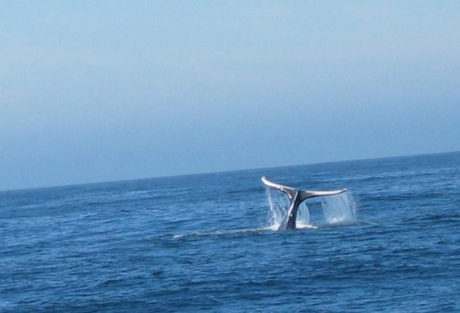
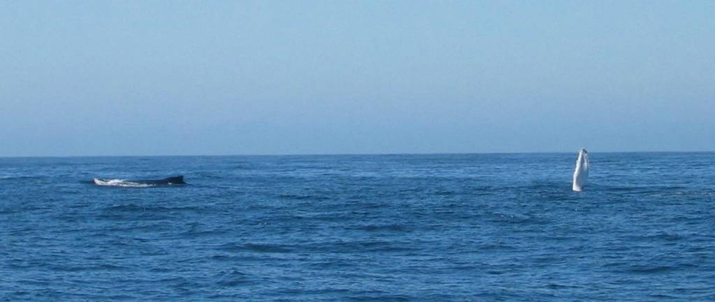
Our course took us around Pt. Pescadero and then south towards Pt. Sur taking us well offshore from Monterey Bay. This turned out to be great for whale watching. The first sighting, of gray whales, was in the late morning. They were nice to look at but since they weren't doing anything interesting we continued without altering course. Then, just before noon, Sharon yelled out "I just saw a BIG fish jump!" Linda and I both turned to see a humpback whale breach clear out of the water (well, it was BIG, even if it wasn't a fish). This we had to see more of, so we altered course to get a closer look. At a range of about a mile we set sail and turned off the engine so we wouldn't disturb their fun. We slowly sailed to within a quarter of a mile; all the while one whale rolled over and over, slapping its huge flippers and its tail on the water. As we got close it was apparent that it was a young whale doing all the frolicking. The other, larger whale was no doubt its mother. We kept a safe distance and spent at least half an hour watching them until the mother whale told the youngster to get moving and they slowly swam away.
Around 1300 the wind was strong enough to keep us moving at over 4 knots so we set the main with the jib and drifter together on the head stay. This configuration worked very well until the wind dropped below 5 knots and we started the motor again. At least we were able to record sightings of more grey whales, Risso's dolphins and Mola Mola before having to motor again.
We should be arriving in Morro Bay tomorrow afternoon, ahead of schedule thanks to all the light winds.
John, Linda and Sharon
1700
At Sea N 36o 36' W 122o (15 nm west of Monterey)
We had a great day today, starting with getting under way from Half Moon Bay at 0630. The wind was light from the east so there was no fog and, even though it was a bit colder than we're used to, we were happy to be underway again. Strange how we can spend a summer in Canada and not get cold until we get to San Francisco. I guess Mark Twain was right.
Our course took us around Pt. Pescadero and then south towards Pt. Sur taking us well offshore from Monterey Bay. This turned out to be great for whale watching. The first sighting, of gray whales, was in the late morning. They were nice to look at but since they weren't doing anything interesting we continued without altering course. Then, just before noon, Sharon yelled out "I just saw a BIG fish jump!" Linda and I both turned to see a humpback whale breach clear out of the water (well, it was BIG, even if it wasn't a fish). This we had to see more of, so we altered course to get a closer look. At a range of about a mile we set sail and turned off the engine so we wouldn't disturb their fun. We slowly sailed to within a quarter of a mile; all the while one whale rolled over and over, slapping its huge flippers and its tail on the water. As we got close it was apparent that it was a young whale doing all the frolicking. The other, larger whale was no doubt its mother. We kept a safe distance and spent at least half an hour watching them until the mother whale told the youngster to get moving and they slowly swam away.
Around 1300 the wind was strong enough to keep us moving at over 4 knots so we set the main with the jib and drifter together on the head stay. This configuration worked very well until the wind dropped below 5 knots and we started the motor again. At least we were able to record sightings of more grey whales, Risso's dolphins and Mola Mola before having to motor again.
We should be arriving in Morro Bay tomorrow afternoon, ahead of schedule thanks to all the light winds.
John, Linda and Sharon
Tuesday, September 21, 2004
Southbound again
September 21, 2004
Half Moon Bay, CA (N 37o 29' W 122o 18')
We departed Redwood City this morning after a hectic week of projects and parties. Our good friend, Sharon, is making the trip to Santa Barbara with us. We were supposed to have an additional crew from Redwood City to Half Moon Bay, but she chose to watch the boat leave her on the dock rather then risk seeing a leatherback sea turtle and several whales with us. (Yes Darla, we saw whales!) We sailed a short time, the wind being light most of the day, and at one point diverted a few miles to investigate an airplane which was circling repeatedly. At first we thought they were looking at whales, then we fantasized that they were spotting tuna for a fishing boat in the area. When we arrived under the circling plane we still couldn't figure out what all the hubbub was about until finally Sharon noticed a small head poking out of the water a half mile away. It was a leatherback sea turtle.
Our time in Redwood City was made far more convenient thanks to Patrick Lawrence who was nice enough to loan us a car! Without it we wouldn't have been able to complete half of what we accomplished while in town. Thanks Patrick!
The project list included sealing the chain plates (which leaked during our Pt. Arena boat wash), fixing the whisker pole (which broke on the trip down the coast), and replacing all the hoses on the toilet. All this along with the normal chores of doing six loads of laundry and shopping. The toilet project turned out to be the most exciting. All of the hoses involved are made out of flexible plastic hose which has a stiff plastic rib embedded in it. The hose is easy to cut to length, easy that is except for the stiff plastic rib. The tool I chose for cutting the hose was a brand new razor knife. Knowing my history with knives I was sure to remind myself that the knife is very sharp and dangerous every time I used it. As a matter of fact, I was doing this very thing while I made the last of six cuts to complete the project. Unfortunately I must not have been listening because as the knife jumped through the stiff plastic rib it passed through the knuckle of my left index finger leaving a rather large cut. After a few preliminary phone calls to clinics in the area (we no longer have our Kaiser health insurance) we jumped in the car (with Linda driving and John applying direct pressure) to find someplace to stitch up the wound.
Our first try was a clinic in Palo Alto. One look at the bloody gauze pad and the woman behind the desk said they don't do that kind of sewing at the P.A. clinic. She suggested we go to Valley Medical Center in San Jose "because it's cheap." So we drove off down the road and after three hours in the waiting room I was stitched up good as new. The only problem being that I had to convince the doctor to put in five stitches. He was going to stop at three.
Finally we got down to the wire on Monday. We had returned Patrick's car and were putting away all the last minute items we had purchased when Linda noticed that her fanny pack was nowhere to be found. She had left it in Patrick's car. A quick call to Patrick and we arranged to have him drop it off before our departure. Patrick saves the day again!
Anyway, we're on our way toward Mexico. Linda and Sharon are sharing the watch duties and I'm on 24 hour standby. Tomorrow we're going to Morro Bay, which will involve being out overnight. We expect to be in late Thursday afternoon.
John, Linda and Sharon
Half Moon Bay, CA (N 37o 29' W 122o 18')
We departed Redwood City this morning after a hectic week of projects and parties. Our good friend, Sharon, is making the trip to Santa Barbara with us. We were supposed to have an additional crew from Redwood City to Half Moon Bay, but she chose to watch the boat leave her on the dock rather then risk seeing a leatherback sea turtle and several whales with us. (Yes Darla, we saw whales!) We sailed a short time, the wind being light most of the day, and at one point diverted a few miles to investigate an airplane which was circling repeatedly. At first we thought they were looking at whales, then we fantasized that they were spotting tuna for a fishing boat in the area. When we arrived under the circling plane we still couldn't figure out what all the hubbub was about until finally Sharon noticed a small head poking out of the water a half mile away. It was a leatherback sea turtle.
Our time in Redwood City was made far more convenient thanks to Patrick Lawrence who was nice enough to loan us a car! Without it we wouldn't have been able to complete half of what we accomplished while in town. Thanks Patrick!
The project list included sealing the chain plates (which leaked during our Pt. Arena boat wash), fixing the whisker pole (which broke on the trip down the coast), and replacing all the hoses on the toilet. All this along with the normal chores of doing six loads of laundry and shopping. The toilet project turned out to be the most exciting. All of the hoses involved are made out of flexible plastic hose which has a stiff plastic rib embedded in it. The hose is easy to cut to length, easy that is except for the stiff plastic rib. The tool I chose for cutting the hose was a brand new razor knife. Knowing my history with knives I was sure to remind myself that the knife is very sharp and dangerous every time I used it. As a matter of fact, I was doing this very thing while I made the last of six cuts to complete the project. Unfortunately I must not have been listening because as the knife jumped through the stiff plastic rib it passed through the knuckle of my left index finger leaving a rather large cut. After a few preliminary phone calls to clinics in the area (we no longer have our Kaiser health insurance) we jumped in the car (with Linda driving and John applying direct pressure) to find someplace to stitch up the wound.
Our first try was a clinic in Palo Alto. One look at the bloody gauze pad and the woman behind the desk said they don't do that kind of sewing at the P.A. clinic. She suggested we go to Valley Medical Center in San Jose "because it's cheap." So we drove off down the road and after three hours in the waiting room I was stitched up good as new. The only problem being that I had to convince the doctor to put in five stitches. He was going to stop at three.
Finally we got down to the wire on Monday. We had returned Patrick's car and were putting away all the last minute items we had purchased when Linda noticed that her fanny pack was nowhere to be found. She had left it in Patrick's car. A quick call to Patrick and we arranged to have him drop it off before our departure. Patrick saves the day again!
Anyway, we're on our way toward Mexico. Linda and Sharon are sharing the watch duties and I'm on 24 hour standby. Tomorrow we're going to Morro Bay, which will involve being out overnight. We expect to be in late Thursday afternoon.
John, Linda and Sharon
Monday, September 20, 2004
Canada pictures now on the web
Pictures from Canada are now on the web, see here:
http://www.employees.org/~gratton/canada/thumbs/gallery
More posts to follow soon, including the story of John's trip to the emergency room and our hectict last minute preparations.
http://www.employees.org/~gratton/canada/thumbs/gallery
More posts to follow soon, including the story of John's trip to the emergency room and our hectict last minute preparations.
Monday, September 13, 2004
In Redwood City
We're in Redwood City for a few days. We have a lot of projects to complete before heading to Southern California so the Blog is going to be inactive during that time.
Soon I'll have some pictures to post from Canada. If you have anything you want to see specifically let me know and I'll see if I can post it.
John
Soon I'll have some pictures to post from Canada. If you have anything you want to see specifically let me know and I'll see if I can post it.
John
Thursday, September 09, 2004
Safe and Sound
September 9, 2004
Drakes Bay (N 38o 00' W 122o 58')
Well we made it. Last night was enough to get us to hasten to Drakes Bay, motoring the afternoon to get here. According to Linda, all the wildlife we saw north of Point Reyes made the night of howling wind and crashing waves worth it. Me, I'm not so sure seeing Mola-Mola (aka sunfish), whales, dolphins, and puffins is enough to erase the memory of last night but it was pretty cool anyway.
We found a new boat maintenance service performed by Mother Nature: The Point Arena Drive Through Boat Wash. Simply take your boat through the area about 15 nm west of Point Arena during a strong northerly blow and your boat will emerge spotless (except for the salt) complete with rinse and blow dry. We had at least three large waves break on top of NAKIA (on both sides and into the cockpit).
It's too bad the worst of the weather occurred at the end of the voyage, had it been the other way around we may have a different opinion of ocean sailing. As it is we wonder about our suitability to crossing oceans. Hopefully this winter in Mexico will help us get a better feeling for our ultimate desires.
On the other hand we can highly recommend the off-shore route for transiting the Washington/Oregon/California coast. We only saw one ship and two or three fishing boats during the entire trip. Compared to our trip in 1997 this was a very relaxing voyage, weather aside.
In any case we're at anchor tonight which is our preferred mode of operation. The best part is that you can set a drink glass down on the table without it spilling when the boat rolls.
Drakes Bay (N 38o 00' W 122o 58')
Well we made it. Last night was enough to get us to hasten to Drakes Bay, motoring the afternoon to get here. According to Linda, all the wildlife we saw north of Point Reyes made the night of howling wind and crashing waves worth it. Me, I'm not so sure seeing Mola-Mola (aka sunfish), whales, dolphins, and puffins is enough to erase the memory of last night but it was pretty cool anyway.
We found a new boat maintenance service performed by Mother Nature: The Point Arena Drive Through Boat Wash. Simply take your boat through the area about 15 nm west of Point Arena during a strong northerly blow and your boat will emerge spotless (except for the salt) complete with rinse and blow dry. We had at least three large waves break on top of NAKIA (on both sides and into the cockpit).
It's too bad the worst of the weather occurred at the end of the voyage, had it been the other way around we may have a different opinion of ocean sailing. As it is we wonder about our suitability to crossing oceans. Hopefully this winter in Mexico will help us get a better feeling for our ultimate desires.
On the other hand we can highly recommend the off-shore route for transiting the Washington/Oregon/California coast. We only saw one ship and two or three fishing boats during the entire trip. Compared to our trip in 1997 this was a very relaxing voyage, weather aside.
In any case we're at anchor tonight which is our preferred mode of operation. The best part is that you can set a drink glass down on the table without it spilling when the boat rolls.
Tuesday, September 07, 2004
Welcome to California!
September 7, 2004
1430 PDT
At Sea N 41o 43' W 125o 57' (75 nm West of Crescent City, CA)
The weather was lumpy last night. Didn't get much sleep, but thankfully today was a little better.
Crossed the boarder into California, so nice to be within the bounds of our home state.
Still planning on a Friday arrival, with the possibility of spending Thursday night in Drakes Bay.
1430 PDT
At Sea N 41o 43' W 125o 57' (75 nm West of Crescent City, CA)
The weather was lumpy last night. Didn't get much sleep, but thankfully today was a little better.
Crossed the boarder into California, so nice to be within the bounds of our home state.
Still planning on a Friday arrival, with the possibility of spending Thursday night in Drakes Bay.
Monday, September 06, 2004
Rollin' rollin' rollin'
September 6, 2004
1830 PDT
At Sea N 43o 30' W 125o 55' (70 miles west of Coos Bay)
It's said that into every life some rain must fall, for the sailor that should be 'into every voyage some heavy wind must blow'. We've been sailing in 18-20 knots of north wind all night and all day with 6-8 foot seas. NAKIA rolls quite a bit under these conditions, but we're taking it as we can. At least the miles are really rolling by too.
We seem to have gotten into a rhythm sleep wise, at least we're not both exhausted. We're looking forward to pulling into San Francisco Thursday night.
1830 PDT
At Sea N 43o 30' W 125o 55' (70 miles west of Coos Bay)
It's said that into every life some rain must fall, for the sailor that should be 'into every voyage some heavy wind must blow'. We've been sailing in 18-20 knots of north wind all night and all day with 6-8 foot seas. NAKIA rolls quite a bit under these conditions, but we're taking it as we can. At least the miles are really rolling by too.
We seem to have gotten into a rhythm sleep wise, at least we're not both exhausted. We're looking forward to pulling into San Francisco Thursday night.
Sunday, September 05, 2004
Sunday Update
September 5, 2004
1900 PDT
At Sea, 80 miles west of Tillamook, OR (N 45o 41' W 125o 58')
We had a good day today, mostly sunny w/ highs in the 70s. The water is very warm, 65 degrees, and VERY blue. It's like we're sailing in a painting.
I put the fishing line out this morning and in about 40 minutes got more then I bargained for. The line I was using has three lures tied one after another. Two of the lures had fish. I forgot that Albacore swim in schools. It took me quite a while to reel them in.
Not much else to report, sleep is hard to come by for me but Linda doesn't seem to have any problems.
1900 PDT
At Sea, 80 miles west of Tillamook, OR (N 45o 41' W 125o 58')
We had a good day today, mostly sunny w/ highs in the 70s. The water is very warm, 65 degrees, and VERY blue. It's like we're sailing in a painting.
I put the fishing line out this morning and in about 40 minutes got more then I bargained for. The line I was using has three lures tied one after another. Two of the lures had fish. I forgot that Albacore swim in schools. It took me quite a while to reel them in.
Not much else to report, sleep is hard to come by for me but Linda doesn't seem to have any problems.
Good Beginnings
September 4, 2004
At Sea (N 47o 20' W 125o 33')
Neah Bay was a bee hive of activity on Friday afternoon. The week end before Labor Day seems to be when everybody leaves Canada to go home. Most of the boats we bound for the Columbia River (Astoria or Portland) though a few were going further. We took the opportunity of a nearby store and stocked up on a few provisions and took nice long showers in the shore side facilities. It may be a week before we take another shower.
We departed Neah Bay at 0600, 30 minutes before sunrise, and motored out past Cape Flattery. The wind soon came up out of the South West, and while that's not the direction we would have preferred the strength was perfect so we set the 115% (probably the first time this sail has been used!) and began beating into the low swell.
I think a lot of sailors discount sailing up wind. In the right conditions, I prefer it to sailing downwind. The wind pressing on the sails keeps the boat more stable and it is much more comfortable then rolling downwind. This was one of those days. We sailed all morning in this fine breeze and only had to motor for a couple of hours in the afternoon.
Even though there's been a ban on all fishing activities by the rest of the crew, I managed to sneak the drag line over the side for a few hours. As luck would have it there are a few Coho still off shore and I hooked one, bringing in and vacuum bagging it whole. We'll have it when we arrive in San Francisco. While cleaning this fish I just let the lures drag about 5 feet behind the boat, I figured they'd be 'safe' there. However, we almost caught another fish right there! Both myself and the aforementioned crew saw a fish strike at the lure. This prompted the afore mentioned crew to remove the lure from the water entirely, lest we actually hook another animal.
People often ask how we manage when we're at sea for an extended time. Of course, someone has to be awake and looking for obstacles at all times. To accomplish this we trade off, every four hours. We're trying a new schedule this time, here's how it goes:
0600-1000
1000-1400
1400-1600 ('1st Dog watch')
1600-1800 ('2nd Dog watch')
1800-2200
2200-0200
0200-0600
The two 'Dog watches' (don't ask me why they're called that, I used to know but not any more) make it so you don't have to stand the dreaded 2200-0200 watch every night.
When one is 'on watch' they have a timepiece, appropriately named 'The Watch', which is set up with an alarm that goes off every 10 minutes. When the alarm sounds it is the responsibility of the person on watch to look at the sea around the boat and make sure there's no ships or other boats that might run us down. Every hour, the person on watch writes our position in the log. That's about all there is, except for sail handling and writing blog reports. If you're off watch there's really only one activity: Sleep. Or at least try to sleep. It's pretty hard to get up at two in the morning for a watch if you haven't had at least a little rest. Oh, there's one other thing you have to do when you're on watch and that is be vewy vewy quite. You don't want to wake up the off watch!
Well that's all for now, it's 0100 and I have an hour left to go before I get to take a nap. I hope I can make it.
John
At Sea (N 47o 20' W 125o 33')
Neah Bay was a bee hive of activity on Friday afternoon. The week end before Labor Day seems to be when everybody leaves Canada to go home. Most of the boats we bound for the Columbia River (Astoria or Portland) though a few were going further. We took the opportunity of a nearby store and stocked up on a few provisions and took nice long showers in the shore side facilities. It may be a week before we take another shower.
We departed Neah Bay at 0600, 30 minutes before sunrise, and motored out past Cape Flattery. The wind soon came up out of the South West, and while that's not the direction we would have preferred the strength was perfect so we set the 115% (probably the first time this sail has been used!) and began beating into the low swell.
I think a lot of sailors discount sailing up wind. In the right conditions, I prefer it to sailing downwind. The wind pressing on the sails keeps the boat more stable and it is much more comfortable then rolling downwind. This was one of those days. We sailed all morning in this fine breeze and only had to motor for a couple of hours in the afternoon.
Even though there's been a ban on all fishing activities by the rest of the crew, I managed to sneak the drag line over the side for a few hours. As luck would have it there are a few Coho still off shore and I hooked one, bringing in and vacuum bagging it whole. We'll have it when we arrive in San Francisco. While cleaning this fish I just let the lures drag about 5 feet behind the boat, I figured they'd be 'safe' there. However, we almost caught another fish right there! Both myself and the aforementioned crew saw a fish strike at the lure. This prompted the afore mentioned crew to remove the lure from the water entirely, lest we actually hook another animal.
People often ask how we manage when we're at sea for an extended time. Of course, someone has to be awake and looking for obstacles at all times. To accomplish this we trade off, every four hours. We're trying a new schedule this time, here's how it goes:
0600-1000
1000-1400
1400-1600 ('1st Dog watch')
1600-1800 ('2nd Dog watch')
1800-2200
2200-0200
0200-0600
The two 'Dog watches' (don't ask me why they're called that, I used to know but not any more) make it so you don't have to stand the dreaded 2200-0200 watch every night.
When one is 'on watch' they have a timepiece, appropriately named 'The Watch', which is set up with an alarm that goes off every 10 minutes. When the alarm sounds it is the responsibility of the person on watch to look at the sea around the boat and make sure there's no ships or other boats that might run us down. Every hour, the person on watch writes our position in the log. That's about all there is, except for sail handling and writing blog reports. If you're off watch there's really only one activity: Sleep. Or at least try to sleep. It's pretty hard to get up at two in the morning for a watch if you haven't had at least a little rest. Oh, there's one other thing you have to do when you're on watch and that is be vewy vewy quite. You don't want to wake up the off watch!
Well that's all for now, it's 0100 and I have an hour left to go before I get to take a nap. I hope I can make it.
John
Thursday, September 02, 2004
Superstitious, who me?
September 2, 2004
Pillar Point, Washington (N 48o 12' W 124o 05')
We had a wonderful sail from Port Angeles to Pillar Point today. We got out a little later then we had hoped because the fuel dock didn't open until 8 am. No big deal, we set sail right out of the harbor and proceeded to sail upwind (with the tide) about 28 nm. It's really amazing how much better NAKIA sails with her new Max-Prop and new UK head sails. I suppose we could have made it all the way to Neah Bay (and so returned to the scene of our crime) but that would have involved motoring and we were having such a fine day we decided to stop and complete the trip tomorrow. The only problem with the day was the temperature. The sun was bright, there were very few clouds, but it didn't get much over 60 degrees all day long. Both Linda and I had to resort to our winter sailing clothes to keep warm.
Pillar Point, unlike any other anchorage we've been in in the Northwest, is not that great. Pillar Point is on the south shore of the Strait of Juan de Fuca and juts out into the main flow of the wind only a quarter of a mile or so. It offers very little protection, but has a clean sand bottom that really took hold of the anchor. The current runs around the point and half the time the wind is against the tide. This makes it very bouncy, at least until the wind dies. If you've anchored in McNear's Beach on a windy day you know what it's like. It says a lot about the remaining upwind 22 nm to Neah Bay that we'd want to stop here at all.
Of course stopping here means we simply must stop at Neah Bay. Linda suggested that we continue out the Strait and on our way to San Francisco instead of stopping. She, unlike me, failed to check the calendar and note the day of the week that September 3 falls on. Friday. Any sailor knows that starting a voyage on a Friday is bad luck. Not that I'm superstitious mind you, its just that I don't like to take any chances. Especially with my luck. So our plan now is to begin our passage to San Francisco on SATURDAY, September 4.
Pillar Point, Washington (N 48o 12' W 124o 05')
We had a wonderful sail from Port Angeles to Pillar Point today. We got out a little later then we had hoped because the fuel dock didn't open until 8 am. No big deal, we set sail right out of the harbor and proceeded to sail upwind (with the tide) about 28 nm. It's really amazing how much better NAKIA sails with her new Max-Prop and new UK head sails. I suppose we could have made it all the way to Neah Bay (and so returned to the scene of our crime) but that would have involved motoring and we were having such a fine day we decided to stop and complete the trip tomorrow. The only problem with the day was the temperature. The sun was bright, there were very few clouds, but it didn't get much over 60 degrees all day long. Both Linda and I had to resort to our winter sailing clothes to keep warm.
Pillar Point, unlike any other anchorage we've been in in the Northwest, is not that great. Pillar Point is on the south shore of the Strait of Juan de Fuca and juts out into the main flow of the wind only a quarter of a mile or so. It offers very little protection, but has a clean sand bottom that really took hold of the anchor. The current runs around the point and half the time the wind is against the tide. This makes it very bouncy, at least until the wind dies. If you've anchored in McNear's Beach on a windy day you know what it's like. It says a lot about the remaining upwind 22 nm to Neah Bay that we'd want to stop here at all.
Of course stopping here means we simply must stop at Neah Bay. Linda suggested that we continue out the Strait and on our way to San Francisco instead of stopping. She, unlike me, failed to check the calendar and note the day of the week that September 3 falls on. Friday. Any sailor knows that starting a voyage on a Friday is bad luck. Not that I'm superstitious mind you, its just that I don't like to take any chances. Especially with my luck. So our plan now is to begin our passage to San Francisco on SATURDAY, September 4.
Bureaucratic Purgatory
August 31, 2004
Neah Bay, Washington USA (N 48o 22' W 124o 36')
We left the Pinkerton Islands and made the short trip to Bamfield, a little town on the south side of Barkley Sound where we would make our way to Neah Bay and the USA. Bamfield is something of a 'split town', one side is serviced by a dirt road that goes into the interior of Vancouver Island, the other side has no roads. The two sides are separated by a narrow strip of water. We tied up to the public dock on the roadless side and took care of our few remaining Canadian dollars by going to the general store and stocking up for the trip to San Francisco.
We departed Bamfield for Neah Bay at oh-dark-thirty, well before sunrise, and headed out onto the mostly calm Pacific Ocean. It was a motor trip all the way and we arrived at around 4pm. I gathered up our passports and boat registration and headed up the dock to call US Customs to check in. A sign on shore gave me the 800 number and in a few moments I was talking to a young man who's first question was 'When was the last time you checked into the US?' I had to think for a minute, it had been a long time, and I wasn't really sure what the last time I checked in has to do with this time. Finally I arrived at the answer, September 1997, when we finished our last trip to Canada in San Francisco. 'Oh,' he says, 'You have to go to Port Angeles.' Now I wasn't really sure how far away Port Angeles was, but I knew I was in Neah Bay, a Customs Port of Entry, and I didn't want to have to go anywhere else to check in. We discussed this, and finally arrived at the reason for going to Port Angeles. Due to Sept. 11, Customs required a physical inspection of any small boat entering the US unless you had been inspected within the last 12 months. More discussion ensued, including a call to the Port Angeles Customs office, and everyone's answer was the same: You have to go to Port Angeles.
You could say I was a little miffed, but I finally resigned myself to the change of plan and went back to the boat to deliver the bad news to Linda. Then I checked and found that Port Angeles is 50 nm from Neah Bay, all the way down the Strait of Juan de Fuca! A 100 nm detour? No way! Back to the phones I went, and more discussion ensued. An alternative was struck, we could go to Grays Harbor, 100nm down the coast. This seemed better to us, at least it was in the right direction. However, an examination of our charts showed that don't have a detailed harbor chart for Grays Harbor. We had no choice, we had to go to Port Angeles.
September 1, 2004
Port Angeles (N 48o 07' W 123o 27')
The trip from Neah Bay was uneventful. The westerlies that the Strait of Juan de Fuca is famous for didn't materialize until we were within 5 miles of Port Angeles, so we didn't do any sailing. We found a convenient spot at the guest dock around 6:30 pm and once again I went ashore to call Customs. This time the man said someone would be right down to inspect us. Now here's the thing. When an officer of the Federal government says he's sending someone to 'inspect' your boat, you get a little nervous. What are they going to do, look through every nook and cranny searching for contraband? Will we be forced to stand on the dock at gun point lest we interfere with them finding our stash of illegal fruit?
In the end, it was quick and painless. The two officers were more interested in the layout and craftsmanship of NAKIA then they were our Canadian purchased meat and produce. Why we couldn't take care of that over the phone is beyond me. Done it was however, 'Welcome to the United States.' We celebrated by mailing our quarterly estimated tax payment for 2004 to the Internal Revenue Service.
Neah Bay, Washington USA (N 48o 22' W 124o 36')
We left the Pinkerton Islands and made the short trip to Bamfield, a little town on the south side of Barkley Sound where we would make our way to Neah Bay and the USA. Bamfield is something of a 'split town', one side is serviced by a dirt road that goes into the interior of Vancouver Island, the other side has no roads. The two sides are separated by a narrow strip of water. We tied up to the public dock on the roadless side and took care of our few remaining Canadian dollars by going to the general store and stocking up for the trip to San Francisco.
We departed Bamfield for Neah Bay at oh-dark-thirty, well before sunrise, and headed out onto the mostly calm Pacific Ocean. It was a motor trip all the way and we arrived at around 4pm. I gathered up our passports and boat registration and headed up the dock to call US Customs to check in. A sign on shore gave me the 800 number and in a few moments I was talking to a young man who's first question was 'When was the last time you checked into the US?' I had to think for a minute, it had been a long time, and I wasn't really sure what the last time I checked in has to do with this time. Finally I arrived at the answer, September 1997, when we finished our last trip to Canada in San Francisco. 'Oh,' he says, 'You have to go to Port Angeles.' Now I wasn't really sure how far away Port Angeles was, but I knew I was in Neah Bay, a Customs Port of Entry, and I didn't want to have to go anywhere else to check in. We discussed this, and finally arrived at the reason for going to Port Angeles. Due to Sept. 11, Customs required a physical inspection of any small boat entering the US unless you had been inspected within the last 12 months. More discussion ensued, including a call to the Port Angeles Customs office, and everyone's answer was the same: You have to go to Port Angeles.
You could say I was a little miffed, but I finally resigned myself to the change of plan and went back to the boat to deliver the bad news to Linda. Then I checked and found that Port Angeles is 50 nm from Neah Bay, all the way down the Strait of Juan de Fuca! A 100 nm detour? No way! Back to the phones I went, and more discussion ensued. An alternative was struck, we could go to Grays Harbor, 100nm down the coast. This seemed better to us, at least it was in the right direction. However, an examination of our charts showed that don't have a detailed harbor chart for Grays Harbor. We had no choice, we had to go to Port Angeles.
September 1, 2004
Port Angeles (N 48o 07' W 123o 27')
The trip from Neah Bay was uneventful. The westerlies that the Strait of Juan de Fuca is famous for didn't materialize until we were within 5 miles of Port Angeles, so we didn't do any sailing. We found a convenient spot at the guest dock around 6:30 pm and once again I went ashore to call Customs. This time the man said someone would be right down to inspect us. Now here's the thing. When an officer of the Federal government says he's sending someone to 'inspect' your boat, you get a little nervous. What are they going to do, look through every nook and cranny searching for contraband? Will we be forced to stand on the dock at gun point lest we interfere with them finding our stash of illegal fruit?
In the end, it was quick and painless. The two officers were more interested in the layout and craftsmanship of NAKIA then they were our Canadian purchased meat and produce. Why we couldn't take care of that over the phone is beyond me. Done it was however, 'Welcome to the United States.' We celebrated by mailing our quarterly estimated tax payment for 2004 to the Internal Revenue Service.
Sunday, August 29, 2004
Pinkerton Islands
August 29, 2004
Pinkerton Islands (N 48o 57' W 125 17')
We made the short trip from Pipestem Inlet to the Pinkerton Islands yesterday morning before the rain started. I immediately put my fishing gear together to make the short trip from the anchorage to one of the hottest fishing areas in Barkley Sound, Swale Rock. We passed this area on our trip from Effingham Bay to Pipestem Inlet and there were about 25 boats fishing there. When I arrived it was clear people still get the weekends off because there were no less then 50 small fishing boats trolling their baits. I put myself to work with the plan of catching at least one fish. How hard could it be, I reasoned, given that boats on all sides were pulling in fish after fish.
Of course they were using natural bait, anchovies, and I had to use my selection of hoochies and spoons. But I was confident that I would eventually find something to fool a fish into biting. That or I would pass by a very stupid fish and he would bite my piece of plastic out of foolishness. Well almost two hours later I was still changing baits without a single bite. I had watched some boats near me pull in three or four fish and I was getting depressed.
About that time I passed by a boat where one of the fishermen was holding his rod, bent to touching the water because of the large fish he was fighting. He looked over at me (must have seen the look of envy on my face) and waved me over. I trolled over to his boat and he asked if I wanted the fish. Well I thought about it. I really wanted to catch a fish, it's fun after all, but the whole idea was simply to get something to put into the freezer for the trip to San Francisco. What the hell, I thought, and said 'yes.' I pulled up my gear and got ready to receive the fish.
Now I figured this was a smallish fish. One that was smaller than others he had caught and he was waiting for a larger one to take home. Not so. When his companion netted the thing it was clear it was a BIG fish! After subduing it with a mallet he said it was probably about 25 pounds. That's more then I bargained for, but I wasn't about to go back on my acceptance of his offer.
It took me over two hours to clean, steak, fillet and vacuum pack that fish. We had to remove everything from the freezer just to fit it all in (we're now on an 'Atkins' diet, we have to eat all the thawed meat!) and worst of all I'm forbidden from fishing again. Oh well, at least we have salmon for the trip home.
The rest of our time here at the Pinkerton Islands has been anticlimactic. It's been raining persistently so we haven't been able to get out and about much, although we did spend an hour exploring during a break in the weather this afternoon. Instead we've been spending today getting ready for the ocean trip to San Francisco, stowing things we won't need and lashing down items that will remain on deck. It looks like the weather will be good on Wednesday, at least the seas will be down, and we can start our trip then.
Tomorrow we're going to Bamfield, a little coastal town, to mail a book back to it's owner (Darrel, who we met in Port Hardy, loaned us his copy of Watmough) and get a few provisions. On Tuesday we plan to go to Neah Bay and check back into the USA and get fuel. Our time in Canada is drawing to a close, we feel like we had to rush through it almost as much as we did in 1997. Maybe we'll wise up for the next trip and go directly to Columbia Cove and simply spend 2 months there. :-)
John and Linda
Pinkerton Islands (N 48o 57' W 125 17')
We made the short trip from Pipestem Inlet to the Pinkerton Islands yesterday morning before the rain started. I immediately put my fishing gear together to make the short trip from the anchorage to one of the hottest fishing areas in Barkley Sound, Swale Rock. We passed this area on our trip from Effingham Bay to Pipestem Inlet and there were about 25 boats fishing there. When I arrived it was clear people still get the weekends off because there were no less then 50 small fishing boats trolling their baits. I put myself to work with the plan of catching at least one fish. How hard could it be, I reasoned, given that boats on all sides were pulling in fish after fish.
Of course they were using natural bait, anchovies, and I had to use my selection of hoochies and spoons. But I was confident that I would eventually find something to fool a fish into biting. That or I would pass by a very stupid fish and he would bite my piece of plastic out of foolishness. Well almost two hours later I was still changing baits without a single bite. I had watched some boats near me pull in three or four fish and I was getting depressed.
About that time I passed by a boat where one of the fishermen was holding his rod, bent to touching the water because of the large fish he was fighting. He looked over at me (must have seen the look of envy on my face) and waved me over. I trolled over to his boat and he asked if I wanted the fish. Well I thought about it. I really wanted to catch a fish, it's fun after all, but the whole idea was simply to get something to put into the freezer for the trip to San Francisco. What the hell, I thought, and said 'yes.' I pulled up my gear and got ready to receive the fish.
Now I figured this was a smallish fish. One that was smaller than others he had caught and he was waiting for a larger one to take home. Not so. When his companion netted the thing it was clear it was a BIG fish! After subduing it with a mallet he said it was probably about 25 pounds. That's more then I bargained for, but I wasn't about to go back on my acceptance of his offer.
It took me over two hours to clean, steak, fillet and vacuum pack that fish. We had to remove everything from the freezer just to fit it all in (we're now on an 'Atkins' diet, we have to eat all the thawed meat!) and worst of all I'm forbidden from fishing again. Oh well, at least we have salmon for the trip home.
The rest of our time here at the Pinkerton Islands has been anticlimactic. It's been raining persistently so we haven't been able to get out and about much, although we did spend an hour exploring during a break in the weather this afternoon. Instead we've been spending today getting ready for the ocean trip to San Francisco, stowing things we won't need and lashing down items that will remain on deck. It looks like the weather will be good on Wednesday, at least the seas will be down, and we can start our trip then.
Tomorrow we're going to Bamfield, a little coastal town, to mail a book back to it's owner (Darrel, who we met in Port Hardy, loaned us his copy of Watmough) and get a few provisions. On Tuesday we plan to go to Neah Bay and check back into the USA and get fuel. Our time in Canada is drawing to a close, we feel like we had to rush through it almost as much as we did in 1997. Maybe we'll wise up for the next trip and go directly to Columbia Cove and simply spend 2 months there. :-)
John and Linda
Friday, August 27, 2004
Lucky Times
August 27, 2004
Lucky Creek, Pipestem Inlet (N 49° 01' W 125° 16')
The weather improved a little yesterday. It's stopped raining for the most part and the sun is making an appearance once in awhile. One thing that didn't improve was the swell. Effingham Bay is quite close to a group of barrier islands. In the quiet of the evening when the wind dropped we could clearly hear the sound of the waves pounding these islands mercilessly. It reminded me of the freeway that I could hear from our berth in Redwood City. I thanked Linda several times for convincing me to make the jump from Tofino to Barkley Sound Tuesday instead of waiting. If we had waited we may have had better wind but we would have much higher seas.
We left Effingham Bay late yesterday afternoon after taking the short trail over the island to the site of an old Native village. In spite of warnings from other boaters about the very muddy trail, we found it to be "an easy hike" of about 1/2 a mile. The beginning was a little muddy, but not nearly enough to require rubber boots.
The trail was just as we remembered it. This section of the British Columbia coast has never been logged or developed. After clambering though dense underbrush near the shore the forest opened up and we found ourselves under the high canopy of cedar trees with the ground covered with moss, a few ferns here and there, and the biggest slugs we've ever seen. Truly a fairy tale landscape. After reaching the other shore we examined the midden and looked for the remains of the native long house (which we were not able to find unfortunately). We sat on the rocky shore and had lunch, watching kayakers slowly paddle by.
After the short trip from Effingham Bay to Pipestem Inlet we anchored in a small bay bounded by a peninsula and three small islands. When we first anchored we thought we would have plenty of room to swing, letting Nakia pivot around the anchor, as we usually do. However, it soon became apparent that a bad wind shift could easily push us onto one of the bounding islands so I ran a line to a cedar tree and tied Nakia's stern to the tree with the line. Amazingly, this is the first time we've had to do this in spite of the fact that boats in nearly all of the anchorages on the inside anchor this way. Of course they do it primarily because everyone else does it. We only do it when we need to.
The anchorage, however, is not the main attraction here. A short dinghy ride away there is a large creek which is deep enough to take a dinghy into at high tide. About a half mile in there are a series of water falls with large pools below each fall. The shores of the creek are too steep to walk on, so to get from one pool to the other you have to swim.
We took the dinghy in about an hour before high tide and had no trouble motoring all the way to the first fall. Then there was a short trail to the first pool above. Fully equipped with bathing suits and reef shoes we prepared to swim the pool to the next fall. That was until we stepped into the water and prepared to dive in. It was COLD (and there was no sun to warm ourselves in afterwards)! Linda was satisfied to have her picture taken sitting on a rock with the falls in the background. I, however, could not come so far without "getting my money's worth." So I dove in and dog paddled, screaming, to the opposite shore where I quickly climbed out and continued along the shore to the next pool. Once arriving at the second, much larger pool I decided that I had seen enough (especially with having to swim back through the first pool just to get back to the dinghy!). I dried off and we ate lunch sitting on a log watching the falls.
Tomorrow we have a short trip to a group of islands called the Pinkerton Islands. There is good salmon fishing close by and the freezer is getting pretty empty. Hopefully I'll get lucky and we'll have enough fish to take home with us.
Lucky Creek, Pipestem Inlet (N 49° 01' W 125° 16')
The weather improved a little yesterday. It's stopped raining for the most part and the sun is making an appearance once in awhile. One thing that didn't improve was the swell. Effingham Bay is quite close to a group of barrier islands. In the quiet of the evening when the wind dropped we could clearly hear the sound of the waves pounding these islands mercilessly. It reminded me of the freeway that I could hear from our berth in Redwood City. I thanked Linda several times for convincing me to make the jump from Tofino to Barkley Sound Tuesday instead of waiting. If we had waited we may have had better wind but we would have much higher seas.
We left Effingham Bay late yesterday afternoon after taking the short trail over the island to the site of an old Native village. In spite of warnings from other boaters about the very muddy trail, we found it to be "an easy hike" of about 1/2 a mile. The beginning was a little muddy, but not nearly enough to require rubber boots.
The trail was just as we remembered it. This section of the British Columbia coast has never been logged or developed. After clambering though dense underbrush near the shore the forest opened up and we found ourselves under the high canopy of cedar trees with the ground covered with moss, a few ferns here and there, and the biggest slugs we've ever seen. Truly a fairy tale landscape. After reaching the other shore we examined the midden and looked for the remains of the native long house (which we were not able to find unfortunately). We sat on the rocky shore and had lunch, watching kayakers slowly paddle by.
After the short trip from Effingham Bay to Pipestem Inlet we anchored in a small bay bounded by a peninsula and three small islands. When we first anchored we thought we would have plenty of room to swing, letting Nakia pivot around the anchor, as we usually do. However, it soon became apparent that a bad wind shift could easily push us onto one of the bounding islands so I ran a line to a cedar tree and tied Nakia's stern to the tree with the line. Amazingly, this is the first time we've had to do this in spite of the fact that boats in nearly all of the anchorages on the inside anchor this way. Of course they do it primarily because everyone else does it. We only do it when we need to.
The anchorage, however, is not the main attraction here. A short dinghy ride away there is a large creek which is deep enough to take a dinghy into at high tide. About a half mile in there are a series of water falls with large pools below each fall. The shores of the creek are too steep to walk on, so to get from one pool to the other you have to swim.
We took the dinghy in about an hour before high tide and had no trouble motoring all the way to the first fall. Then there was a short trail to the first pool above. Fully equipped with bathing suits and reef shoes we prepared to swim the pool to the next fall. That was until we stepped into the water and prepared to dive in. It was COLD (and there was no sun to warm ourselves in afterwards)! Linda was satisfied to have her picture taken sitting on a rock with the falls in the background. I, however, could not come so far without "getting my money's worth." So I dove in and dog paddled, screaming, to the opposite shore where I quickly climbed out and continued along the shore to the next pool. Once arriving at the second, much larger pool I decided that I had seen enough (especially with having to swim back through the first pool just to get back to the dinghy!). I dried off and we ate lunch sitting on a log watching the falls.
Tomorrow we have a short trip to a group of islands called the Pinkerton Islands. There is good salmon fishing close by and the freezer is getting pretty empty. Hopefully I'll get lucky and we'll have enough fish to take home with us.
Tuesday, August 24, 2004
Tofino and Barkley Sound
August 24, 2004
Effingham Bay, Barkley Sound (N 48° 52' W 125° 18')
We spent the nights of August 22 and 23 in Tofino after making a quick passage from Young Bay. One of these trips we're going to get to the west coast early enough in the season so we don't feel like we have to make tracks south. As it is, we feel like the trip home is lurking over our heads so we cruise down the coast without stopping at places that look interesting. Oh well, we will just have to come back again and do it right.
Tofino is (was) our last "big" town before returning to the U.S. (though we may make a quick stop in Ucluelet for fresh fruit and veggies for the trip home). If I had to describe Tofino, I'd say it's a cross between Half Moon Bay and Berkeley. It has the small, fishing village feel of Half Moon Bay and the sandalwood scented/dread locked/liberal attitude of Berkeley. We had two meals out: fish and chips for dinner and pizza for lunch. Quite different from our trip in 1997 when we ate lunch at a trendy style cafe that had just opened. The cafe was still there, but was only open for dinner and the prices had gone up considerably.
We arrived on the afternoon of the 22nd and did laundry for the first time since July 30. Strangely enough it only took 90 minutes to complete this chore, thanks to the new triple loader washers in the laundromat. I'm not sure I ever mentioned this before, but I get to play "pack mule" whenever we do laundry. We have found the easiest way to transport things like laundry and propane tanks is on a back pack frame, the docks being too rough and uneven for rolling a cart. So we bag all the bedding and many weeks worth of T-shirts, underwear, pants, and sweatshirts and strap them to the pack frame. Then I get to sling it on my back and carry it however far we need to go. In Tofino the laundromat is not far, but the marina is at the bottom of a very steep hill which makes laundry day a special work out.
Today we made the jump from Tofino to Barkley Sound. It's about 35 miles in a southeast direction. We just managed to make it in before the weather. The 4 AM forecast called for wind out of the southwest at 10-20 knots. That would have been great, except that this was the only area forecast to blow from the southwest. Every other forecast area was supposed to have wind out of the southeast. I figured the guy recording the forecast had misread it. Sure enough, when they came out with the 10:30 forecast it was for southeast. Thankfully it never blew hard enough to impede our progress and the only problem we had was reduced visibility while bands of rain came through.
Oh, we did have one other exciting moment. We were entering the islands of Barkley Sound. I was out on the bow making sure we were heading through an appropriate gap in the rocks and Linda was at the wheel taking directions. I was checking the chart when all of a sudden Linda shouted and threw the boat into neutral. I look up expecting to see a rock that I had missed directly in front of us, but there was nothing there. I looked back at Linda and she yelled, "A whale, we almost hit a whale!" It had surfaced about 30 ft in front and to the right of NAKIA while I was looking at the chart. Thankfully we didn't feel any bumps and we continued on into the protection of the islands without further incident.
The rain started coming down in earnest just before we got the anchor down. That's fine though, at least we had reason to appreciate our afternoon tea and cookies. Hopefully the rain will stop tomorrow and we can take the trail to the other side of the island. We've done this one before so we know it's "an easy walk."
Effingham Bay, Barkley Sound (N 48° 52' W 125° 18')
We spent the nights of August 22 and 23 in Tofino after making a quick passage from Young Bay. One of these trips we're going to get to the west coast early enough in the season so we don't feel like we have to make tracks south. As it is, we feel like the trip home is lurking over our heads so we cruise down the coast without stopping at places that look interesting. Oh well, we will just have to come back again and do it right.
Tofino is (was) our last "big" town before returning to the U.S. (though we may make a quick stop in Ucluelet for fresh fruit and veggies for the trip home). If I had to describe Tofino, I'd say it's a cross between Half Moon Bay and Berkeley. It has the small, fishing village feel of Half Moon Bay and the sandalwood scented/dread locked/liberal attitude of Berkeley. We had two meals out: fish and chips for dinner and pizza for lunch. Quite different from our trip in 1997 when we ate lunch at a trendy style cafe that had just opened. The cafe was still there, but was only open for dinner and the prices had gone up considerably.
We arrived on the afternoon of the 22nd and did laundry for the first time since July 30. Strangely enough it only took 90 minutes to complete this chore, thanks to the new triple loader washers in the laundromat. I'm not sure I ever mentioned this before, but I get to play "pack mule" whenever we do laundry. We have found the easiest way to transport things like laundry and propane tanks is on a back pack frame, the docks being too rough and uneven for rolling a cart. So we bag all the bedding and many weeks worth of T-shirts, underwear, pants, and sweatshirts and strap them to the pack frame. Then I get to sling it on my back and carry it however far we need to go. In Tofino the laundromat is not far, but the marina is at the bottom of a very steep hill which makes laundry day a special work out.
Today we made the jump from Tofino to Barkley Sound. It's about 35 miles in a southeast direction. We just managed to make it in before the weather. The 4 AM forecast called for wind out of the southwest at 10-20 knots. That would have been great, except that this was the only area forecast to blow from the southwest. Every other forecast area was supposed to have wind out of the southeast. I figured the guy recording the forecast had misread it. Sure enough, when they came out with the 10:30 forecast it was for southeast. Thankfully it never blew hard enough to impede our progress and the only problem we had was reduced visibility while bands of rain came through.
Oh, we did have one other exciting moment. We were entering the islands of Barkley Sound. I was out on the bow making sure we were heading through an appropriate gap in the rocks and Linda was at the wheel taking directions. I was checking the chart when all of a sudden Linda shouted and threw the boat into neutral. I look up expecting to see a rock that I had missed directly in front of us, but there was nothing there. I looked back at Linda and she yelled, "A whale, we almost hit a whale!" It had surfaced about 30 ft in front and to the right of NAKIA while I was looking at the chart. Thankfully we didn't feel any bumps and we continued on into the protection of the islands without further incident.
The rain started coming down in earnest just before we got the anchor down. That's fine though, at least we had reason to appreciate our afternoon tea and cookies. Hopefully the rain will stop tomorrow and we can take the trail to the other side of the island. We've done this one before so we know it's "an easy walk."
Saturday, August 21, 2004
Head Games
August 21, 2004
Young Bay (N 49° 25' W 126° 13')
We slept terribly at Hot Springs Cove with the fishing boats' generators running all night, and got going early Friday morning to move to Young Bay before the first float plane landed. Young Bay is just a few miles from Hot Springs Cove and when we arrived we found it had the two features we wanted most: 1) it was unoccupied and 2) it was quiet!
After arriving, we waited for high tide so we could take the dinghy to shore where the guidebook assured us "an easy walk" of 1/2 a mile would take us to a lake suitable for swimming and bathing. The guidebook wasn't clear where in Young Bay the trailhead was, however another guidebook said it was on the south side of the bay. We decided not to bother putting the engine on since Young Bay is small, and how hard would it be to find the trailhead anyway because the guidebook says it's on the south side. So John rowed all over the place putting Linda ashore at a couple of different spots to search for the trailhead. As Linda started to investigate one faint trail she managed to land her foot right smack dab in the middle of a very fresh pile of bear scat. She quickly decided that she would not be following that trail any farther! Fortunately the scat consisted of mostly crushed berries which only stained the bottom of her reef walker shoe bright purple.
We eventually found the well-indicated (by surveyor ribbon) trailhead up the creek on the east end of the bay (which is where Linda suggested we should have started in the first place; I guess sometimes it's better to ignore the guidebook). Unfortunately it was a very rough trail, definitely not "an easy walk." We struggled along for 15 minutes only to reach the first of two ponds before you get to the lake itself. The ribbons seemed to go to the pond (which was surrounded by logs in the water - no shore) but it was impossible to tell where you were supposed to continue from there. At this point Linda was feeling a bit like she would scream at the slightest thing (after finding the mother of all daddy-long-legs crawling on her hat), and we were both sweating bullets. Figuring a bath in a freshwater lake was kind of pointless if we were going to have to get all sweaty just getting back to the dinghy, we high-tailed it back out of there! We opted for showers right away and opened a bottle of wine with dinner to soothe our frayed nerves.
We were supposed to leave today for Matilda Inlet but since it was raining we decided to sit tight to see if it would clear. We haven't had many "rain days" so we were looking forward to sitting below drinking tea and reading. Unfortunately the discovery that the head was clogged put an end to that. Of course this discovery occurred after the holding tank was full and to clear the clog we would have to empty the tank. Of course, catch 22, the clog is what was preventing the tank from emptying. In the end we sacrificed the hand pump we use to change the oil to pump the contents of the tank overboard through the pump-out fitting. Then we put vinegar and baking soda (Linda's special de-clogger recipe!) down the pump-out fitting. We let that fizz for a while then poured boiling water down the hose after it. It took two applications, but we were able to clear the clog. We came through the experience well enough, only gagging a couple of times while pumping the tank out.
We're going to give the trip to Matilda Inlet a try again tomorrow. The guidebook says there's a warm springs within "an easy walk" of the anchorage. I hope we don't need our rock climbing gear for this one.
Young Bay (N 49° 25' W 126° 13')
We slept terribly at Hot Springs Cove with the fishing boats' generators running all night, and got going early Friday morning to move to Young Bay before the first float plane landed. Young Bay is just a few miles from Hot Springs Cove and when we arrived we found it had the two features we wanted most: 1) it was unoccupied and 2) it was quiet!
After arriving, we waited for high tide so we could take the dinghy to shore where the guidebook assured us "an easy walk" of 1/2 a mile would take us to a lake suitable for swimming and bathing. The guidebook wasn't clear where in Young Bay the trailhead was, however another guidebook said it was on the south side of the bay. We decided not to bother putting the engine on since Young Bay is small, and how hard would it be to find the trailhead anyway because the guidebook says it's on the south side. So John rowed all over the place putting Linda ashore at a couple of different spots to search for the trailhead. As Linda started to investigate one faint trail she managed to land her foot right smack dab in the middle of a very fresh pile of bear scat. She quickly decided that she would not be following that trail any farther! Fortunately the scat consisted of mostly crushed berries which only stained the bottom of her reef walker shoe bright purple.
We eventually found the well-indicated (by surveyor ribbon) trailhead up the creek on the east end of the bay (which is where Linda suggested we should have started in the first place; I guess sometimes it's better to ignore the guidebook). Unfortunately it was a very rough trail, definitely not "an easy walk." We struggled along for 15 minutes only to reach the first of two ponds before you get to the lake itself. The ribbons seemed to go to the pond (which was surrounded by logs in the water - no shore) but it was impossible to tell where you were supposed to continue from there. At this point Linda was feeling a bit like she would scream at the slightest thing (after finding the mother of all daddy-long-legs crawling on her hat), and we were both sweating bullets. Figuring a bath in a freshwater lake was kind of pointless if we were going to have to get all sweaty just getting back to the dinghy, we high-tailed it back out of there! We opted for showers right away and opened a bottle of wine with dinner to soothe our frayed nerves.
We were supposed to leave today for Matilda Inlet but since it was raining we decided to sit tight to see if it would clear. We haven't had many "rain days" so we were looking forward to sitting below drinking tea and reading. Unfortunately the discovery that the head was clogged put an end to that. Of course this discovery occurred after the holding tank was full and to clear the clog we would have to empty the tank. Of course, catch 22, the clog is what was preventing the tank from emptying. In the end we sacrificed the hand pump we use to change the oil to pump the contents of the tank overboard through the pump-out fitting. Then we put vinegar and baking soda (Linda's special de-clogger recipe!) down the pump-out fitting. We let that fizz for a while then poured boiling water down the hose after it. It took two applications, but we were able to clear the clog. We came through the experience well enough, only gagging a couple of times while pumping the tank out.
We're going to give the trip to Matilda Inlet a try again tomorrow. The guidebook says there's a warm springs within "an easy walk" of the anchorage. I hope we don't need our rock climbing gear for this one.
Thursday, August 19, 2004
Hot Springs Cove
August 19, 2004
Hot Springs Cove (N 49° 22' W 126° 16')
Today we made the long jump from Nuchatlitz Inlet to Hot Springs Cove. We had a good, if a little too long (53 nm) and a little too rough, sail all the way down the coast. The last few miles of it we sailed a mile or so away from Pacific Swift, the same square rigged schooner that we were tied up next to in Uclulet in 1997. We thought we might show them how it's done by sailing all the way into the anchorage but when the wind shifted at the entrance, we chickened out and motored the last half mile.
I'm sure at one time Hot Springs Cove was a really nice place, but now it simply is not. In addition to high speed tour boats that bring people in by the dozens, float planes fly in every few minutes dropping off and picking up passengers. The float planes take off and land within 50 yards of our boat. There are half a dozen fishing boats in the anchorage, all of them running generators constantly. And to top it all off there's a camp on shore where a dog is howling as though it's being murdered. Its owners left it while they went off to soak in the hot springs, no doubt, oblivious to the unpleasant setting they are leaving for their neighbors.
Linda says she wants to stay here two days, since we went through a long hard sail to get here. Personally I'd leave tonight if I thought I could navigate from here to the next anchorage in the dark...
Hot Springs Cove (N 49° 22' W 126° 16')
Today we made the long jump from Nuchatlitz Inlet to Hot Springs Cove. We had a good, if a little too long (53 nm) and a little too rough, sail all the way down the coast. The last few miles of it we sailed a mile or so away from Pacific Swift, the same square rigged schooner that we were tied up next to in Uclulet in 1997. We thought we might show them how it's done by sailing all the way into the anchorage but when the wind shifted at the entrance, we chickened out and motored the last half mile.
I'm sure at one time Hot Springs Cove was a really nice place, but now it simply is not. In addition to high speed tour boats that bring people in by the dozens, float planes fly in every few minutes dropping off and picking up passengers. The float planes take off and land within 50 yards of our boat. There are half a dozen fishing boats in the anchorage, all of them running generators constantly. And to top it all off there's a camp on shore where a dog is howling as though it's being murdered. Its owners left it while they went off to soak in the hot springs, no doubt, oblivious to the unpleasant setting they are leaving for their neighbors.
Linda says she wants to stay here two days, since we went through a long hard sail to get here. Personally I'd leave tonight if I thought I could navigate from here to the next anchorage in the dark...
Sea Otters and New Moons
August 18, 2004
Mary Basin, Nuchatlitz Inlet (N 49° 47' W 126° 50')
When we left Rugged Point yesterday bound for Mary Basin we only intended to stay overnight. But when an early afternoon fog chased us into Nuchatlitz Inlet and several sea otters greeted us on the way in we decided to stay an extra day and take in some of the sights in the area.
Nuchatlitz Inlet indents the western side of Nootka Island on the west side of Vancouver Island. In March of 1778, in a small cove near Nootka Island, Captain James Cook, R.N., became the first European to set foot on what later became British Columbia. According to our guide book (Cruising Guide to the West Coast of Vancouver Island by Don Watmough), Cook named Nootka Island after the word the natives chanted as he approached: "noot-ka, noot-ka." Only later was the true meaning of the chant learned: it's an imperative advising the listener to "go around!" We, unlike Cook, decided to follow the advice of the natives and go around the outside of Nootka Island without stopping in the fjords that separate it from Vancouver Island. Mary Basin is our only stop in this area.
Mary Basin is open, quiet, uncrowded, and filled with wildlife. There are several large sandy beaches close by for walking, and the outer cliffs have many sea caves. While exploring in the dinghy this morning we saw a black bear on one of the beaches eating mussels off the rocks at low tide. The small channel separating Nuchatlitz Inlet from Mary Basin is home to five or so sea otters. They come into the basin now and then to sleep quietly, their hind flippers and forepaws held above the surface. They are just too cute for words. We've also identified red throated loons in the basin, which we've not seen before. All in all, this has been a great place to spend a couple of days.
Tomorrow we'll be moving to Clayoquot (CLAY-kit) Sound and the fabled Hot Springs Cove. We had resolved not to go to the springs as they are just too crowded for us (high speed tour boats and float planes make runs from Tofino bringing tourists by the dozens). But it's a convenient waypoint on our way south.
For some strange reason over the last few years I have gotten into the habit of measuring months by the phase of the moon. I think of some date in the future, and instead of thinking, "that's three months from now," I think, "that's three new moons from now." This evening was no different when Linda brought my attention to the setting crescent of the moon. I looked at it and realized it's the first quarter of the new moon, the new moon who's last quarter will shine on Nakia's wake as she makes her way back to her home waters in the Bay Area in September. It's a small reminder that we need to enjoy ourselves while we can because our time here is short.
Mary Basin, Nuchatlitz Inlet (N 49° 47' W 126° 50')
When we left Rugged Point yesterday bound for Mary Basin we only intended to stay overnight. But when an early afternoon fog chased us into Nuchatlitz Inlet and several sea otters greeted us on the way in we decided to stay an extra day and take in some of the sights in the area.
Nuchatlitz Inlet indents the western side of Nootka Island on the west side of Vancouver Island. In March of 1778, in a small cove near Nootka Island, Captain James Cook, R.N., became the first European to set foot on what later became British Columbia. According to our guide book (Cruising Guide to the West Coast of Vancouver Island by Don Watmough), Cook named Nootka Island after the word the natives chanted as he approached: "noot-ka, noot-ka." Only later was the true meaning of the chant learned: it's an imperative advising the listener to "go around!" We, unlike Cook, decided to follow the advice of the natives and go around the outside of Nootka Island without stopping in the fjords that separate it from Vancouver Island. Mary Basin is our only stop in this area.
Mary Basin is open, quiet, uncrowded, and filled with wildlife. There are several large sandy beaches close by for walking, and the outer cliffs have many sea caves. While exploring in the dinghy this morning we saw a black bear on one of the beaches eating mussels off the rocks at low tide. The small channel separating Nuchatlitz Inlet from Mary Basin is home to five or so sea otters. They come into the basin now and then to sleep quietly, their hind flippers and forepaws held above the surface. They are just too cute for words. We've also identified red throated loons in the basin, which we've not seen before. All in all, this has been a great place to spend a couple of days.
Tomorrow we'll be moving to Clayoquot (CLAY-kit) Sound and the fabled Hot Springs Cove. We had resolved not to go to the springs as they are just too crowded for us (high speed tour boats and float planes make runs from Tofino bringing tourists by the dozens). But it's a convenient waypoint on our way south.
For some strange reason over the last few years I have gotten into the habit of measuring months by the phase of the moon. I think of some date in the future, and instead of thinking, "that's three months from now," I think, "that's three new moons from now." This evening was no different when Linda brought my attention to the setting crescent of the moon. I looked at it and realized it's the first quarter of the new moon, the new moon who's last quarter will shine on Nakia's wake as she makes her way back to her home waters in the Bay Area in September. It's a small reminder that we need to enjoy ourselves while we can because our time here is short.
Tuesday, August 17, 2004
Rugged Point
August 17, 2004
Rugged Point (N 49° 58' W 127° 15')
We left the security and beauty of the Bunsby Islands yesterday for the open sandy beaches of Rugged Point. During our short stay at the Bunsbys we saw a large diversity of wildlife including:
Bald eagle (an anchorage is not complete without at least one bald eagle)
Osprey
Blue heron
Kingfisher
Raven
Black oyster catcher
Black bear
Harbor seal
Sea otter
All in all, the Bunsbys were one of the best places we've been and we'll definitely go back.
On our way to Rugged Point, we stopped at the little town of Kyuquot (Ki-YOU-kit) to fill the water tanks, get a few provisions, and see if we could swap some books. By the way, you should always be suspicious when a sailor says "we needed a few provisions." Usually it means they needed beer and potato chips. In this case, Kyuquot doesn't have alcohol (by local Native ordinance) so 'provisions' meant potato chips and ice cream. Of course we also had to buy eggs and bread to make it look like we didn't go just for chips and ice cream.
Kyuquot is located in Walters Cove (N 50° 01' W 127° 22') and is actually two towns. The Native town, Walters Cove, is on the Vancouver Island side of the cove and the "white" town, Kyuquot, is on an island across the cove. The Natives seem to have most of the political power, but that doesn't seem to stop everyone from getting along very well. The twin towns of Kyuquot/Walters Cove seem to be better adjusted than any other place we've visited with a mixed Native/Anglo population.
The third population in Kyuquot/Walters Cove seems to be sea otters. The closer you get to town, the more sea otters there are, and in a smaller cove right outside the main cove there is a group of about 25 that lounge together in the kelp. They seem to be as well adjusted as the rest of the population and are very tolerant of people. We were able to cruise by their little kelp town and take pictures without disturbing them at all.
From Kyuquot it's a short hop to Rugged Point Marine Park, a granite peninsula wooded with old growth Douglas fir, which has several white sand beaches as its claim to fame. There are three beaches on the north "inside" of the point, and four beaches (one over a half mile long) on the south "outside" of the point. A trail leads between the north and south sides. Unfortunately the anchorage at Rugged Point is not particularly protected. We're anchored in a notch on the north side of the peninsula between two granite fingers that jut out to the north from the point. The southwest swell wraps around the point and makes it a little rolly. It's not that bad really, we've been in rollier anchorages. The real problem is if the wind comes out of the north (as it's doing at this moment), we are in one nasty lee shore and if the anchor drags at all we'll be on the rocks in seconds. Did I mention that it's three in the morning and I'm sitting up watching the radar making sure we don't drag? I think I forgot that part... Anyway the wind is dying down and it looks like I should be able to go back to bed soon. Later this morning we'll get up and take the dinghy ashore to explore the beaches. That is, after all why we came here.
Rugged Point (N 49° 58' W 127° 15')
We left the security and beauty of the Bunsby Islands yesterday for the open sandy beaches of Rugged Point. During our short stay at the Bunsbys we saw a large diversity of wildlife including:
Bald eagle (an anchorage is not complete without at least one bald eagle)
Osprey
Blue heron
Kingfisher
Raven
Black oyster catcher
Black bear
Harbor seal
Sea otter
All in all, the Bunsbys were one of the best places we've been and we'll definitely go back.
On our way to Rugged Point, we stopped at the little town of Kyuquot (Ki-YOU-kit) to fill the water tanks, get a few provisions, and see if we could swap some books. By the way, you should always be suspicious when a sailor says "we needed a few provisions." Usually it means they needed beer and potato chips. In this case, Kyuquot doesn't have alcohol (by local Native ordinance) so 'provisions' meant potato chips and ice cream. Of course we also had to buy eggs and bread to make it look like we didn't go just for chips and ice cream.
Kyuquot is located in Walters Cove (N 50° 01' W 127° 22') and is actually two towns. The Native town, Walters Cove, is on the Vancouver Island side of the cove and the "white" town, Kyuquot, is on an island across the cove. The Natives seem to have most of the political power, but that doesn't seem to stop everyone from getting along very well. The twin towns of Kyuquot/Walters Cove seem to be better adjusted than any other place we've visited with a mixed Native/Anglo population.
The third population in Kyuquot/Walters Cove seems to be sea otters. The closer you get to town, the more sea otters there are, and in a smaller cove right outside the main cove there is a group of about 25 that lounge together in the kelp. They seem to be as well adjusted as the rest of the population and are very tolerant of people. We were able to cruise by their little kelp town and take pictures without disturbing them at all.
From Kyuquot it's a short hop to Rugged Point Marine Park, a granite peninsula wooded with old growth Douglas fir, which has several white sand beaches as its claim to fame. There are three beaches on the north "inside" of the point, and four beaches (one over a half mile long) on the south "outside" of the point. A trail leads between the north and south sides. Unfortunately the anchorage at Rugged Point is not particularly protected. We're anchored in a notch on the north side of the peninsula between two granite fingers that jut out to the north from the point. The southwest swell wraps around the point and makes it a little rolly. It's not that bad really, we've been in rollier anchorages. The real problem is if the wind comes out of the north (as it's doing at this moment), we are in one nasty lee shore and if the anchor drags at all we'll be on the rocks in seconds. Did I mention that it's three in the morning and I'm sitting up watching the radar making sure we don't drag? I think I forgot that part... Anyway the wind is dying down and it looks like I should be able to go back to bed soon. Later this morning we'll get up and take the dinghy ashore to explore the beaches. That is, after all why we came here.
Sunday, August 15, 2004
The Bunsbys
August 15, 2004
Bunsby Islands (N 50° 6' W 127° 31')
We arrived at the Bunsby Islands yesterday morning after our trip from Columbia Cove and were reminded of one of the distinguishing features of the west coast of Vancouver Island: rocks. Lots of rocks. Scattered everywhere. Not that we hit one or anything, but it's a whole 'nother ballgame out here as compared to the inside. We go slower and scout carefully before entering a "rock pile." Many of these dangers are marked by kelp or they stick up above the surface at low tide. They are the easy ones to spot. Others are nothing more than a white smear in the otherwise dark water. The worst ones are so deep that only the depth sounder will tell you that they are about to jump up off an otherwise smooth bottom and grab your boat.
It was worth it though. After threading our way in we went out for a ride in the dinghy and found a fantastic miniature sandy beach which was created by the ocean swell driving over a rocky reef through a narrow slit in the reef. The sand was so fine and clean it looked tropical.
After our dinghy ride we came back to Nakia and sat on the foredeck and watched our mascot, "Crab Crusher," eat lunch. Crab Crusher is a sea otter who's been hanging around our little cove. He seems to have a great fondness for red rock crab and swims along the shore diving for them and then floating on his back crunching them loudly, with the sounds of him eating echoing off the trees.
After Crab Crusher had left Linda sat on the foredeck quietly reading. I was working below and when I went up on deck there was a large black bear foraging on the beach 150 yards away. I told Linda, "You have to look around once in a while!" We had a great time watching him flip over rocks and then eating whatever he found underneath.
This morning being Sunday we had a special breakfast. Salmon (what a surprise) thinly sliced and fried in butter placed over toast with eggs over easy on top, then topped with Hollandaise sauce. Yum!
After completing some chores we spent the afternoon exploring in the dinghy, this time visiting a small inlet nearby which has the remains of an old native fish weir. I'm not really sure what a fish weir is, but we saw it anyway. We also spent some time watching an osprey diving for herring. It was the first osprey we've seen in Canada. The morning overcast burned off by the time we were exploring the fish weir and it was another beautiful sunny afternoon.
This evening we were reminded of one of the other distinguishing features of the west coast: fog! We had just finished dinner and I looked out to see a fog bank rolling in. Within half an hour we couldn't see out of the anchorage 1/4 mile away. If it's like this tomorrow morning, we won't be going anywhere (we had planned to leave for Rugged Point or thereabouts via Walters Cove). We've been extremely fortunate with the weather this time so we can't complain!
Bunsby Islands (N 50° 6' W 127° 31')
We arrived at the Bunsby Islands yesterday morning after our trip from Columbia Cove and were reminded of one of the distinguishing features of the west coast of Vancouver Island: rocks. Lots of rocks. Scattered everywhere. Not that we hit one or anything, but it's a whole 'nother ballgame out here as compared to the inside. We go slower and scout carefully before entering a "rock pile." Many of these dangers are marked by kelp or they stick up above the surface at low tide. They are the easy ones to spot. Others are nothing more than a white smear in the otherwise dark water. The worst ones are so deep that only the depth sounder will tell you that they are about to jump up off an otherwise smooth bottom and grab your boat.
It was worth it though. After threading our way in we went out for a ride in the dinghy and found a fantastic miniature sandy beach which was created by the ocean swell driving over a rocky reef through a narrow slit in the reef. The sand was so fine and clean it looked tropical.
After our dinghy ride we came back to Nakia and sat on the foredeck and watched our mascot, "Crab Crusher," eat lunch. Crab Crusher is a sea otter who's been hanging around our little cove. He seems to have a great fondness for red rock crab and swims along the shore diving for them and then floating on his back crunching them loudly, with the sounds of him eating echoing off the trees.
After Crab Crusher had left Linda sat on the foredeck quietly reading. I was working below and when I went up on deck there was a large black bear foraging on the beach 150 yards away. I told Linda, "You have to look around once in a while!" We had a great time watching him flip over rocks and then eating whatever he found underneath.
This morning being Sunday we had a special breakfast. Salmon (what a surprise) thinly sliced and fried in butter placed over toast with eggs over easy on top, then topped with Hollandaise sauce. Yum!
After completing some chores we spent the afternoon exploring in the dinghy, this time visiting a small inlet nearby which has the remains of an old native fish weir. I'm not really sure what a fish weir is, but we saw it anyway. We also spent some time watching an osprey diving for herring. It was the first osprey we've seen in Canada. The morning overcast burned off by the time we were exploring the fish weir and it was another beautiful sunny afternoon.
This evening we were reminded of one of the other distinguishing features of the west coast: fog! We had just finished dinner and I looked out to see a fog bank rolling in. Within half an hour we couldn't see out of the anchorage 1/4 mile away. If it's like this tomorrow morning, we won't be going anywhere (we had planned to leave for Rugged Point or thereabouts via Walters Cove). We've been extremely fortunate with the weather this time so we can't complain!
Friday, August 13, 2004
A Day at the Beach
August 13, 2004
Columbia Cove
We spent the entire day today at the beach. The weather couldn't have been nicer. Although today there were a number of other beachgoers who, while not making it crowded, made it something less than deserted so we weren't able to go au naturel.
We started out the day doing a little beachcombing. I wanted to find a piece of fishing net and we're always on the lookout for a glass fishing float. There are dozens of fishing floats on this beach but they're made of anything but glass (plastic mostly, but also foam, and even aluminum!). Having found a nice piece of fish net we set about spending the rest of the day sitting in a hammock which was also made from fishing net washed up on the beach. Someone had made the hammock, a picnic table, and benches all out of things found among the driftwood. The only thing missing is a Deposito (for buying a cold six pack of Corona).
Strangely enough we're leaving tomorrow to go to the Bunsby Islands. We both say we should have stayed here an entire week but time is ticking by and we want to see more of the west coast before we leave Canada. The Bunsbys are supposed to be home to many sea otters, some of which have been re-released to the wild, so we're hoping for a different kind of entertainment.
Columbia Cove
We spent the entire day today at the beach. The weather couldn't have been nicer. Although today there were a number of other beachgoers who, while not making it crowded, made it something less than deserted so we weren't able to go au naturel.
We started out the day doing a little beachcombing. I wanted to find a piece of fishing net and we're always on the lookout for a glass fishing float. There are dozens of fishing floats on this beach but they're made of anything but glass (plastic mostly, but also foam, and even aluminum!). Having found a nice piece of fish net we set about spending the rest of the day sitting in a hammock which was also made from fishing net washed up on the beach. Someone had made the hammock, a picnic table, and benches all out of things found among the driftwood. The only thing missing is a Deposito (for buying a cold six pack of Corona).
Strangely enough we're leaving tomorrow to go to the Bunsby Islands. We both say we should have stayed here an entire week but time is ticking by and we want to see more of the west coast before we leave Canada. The Bunsbys are supposed to be home to many sea otters, some of which have been re-released to the wild, so we're hoping for a different kind of entertainment.
Thursday, August 12, 2004
I'm a Sick, Sick Man
August 12, 2004
Columbia Cove (N 50° 08' W 127° 41')
We made our rounding of Cape Cook this morning at 1100. We're both glad we got up a little earlier than we had first planned because the Cape was blowing 20 kts when we got there, and I'm sure it did nothing but increase all afternoon. No unusual wildlife to report, I guess the albatross are keeping farther offshore lately.
Now for the sick part. If you've been following this web log you know we are currently inundated with fish. I have two pink salmon in the freezer, along with the better part of a lingcod as well as an entire coho which was given to us in Winter Harbour. You'd think I'd refrain from fishing, wouldn't you? But no, I'm a sick man. This morning as we were leaving I put out the green and white hoochy that caught "the one that got away." As I said before, trailing a hoochy on the surface has never been very successful, so I figured it probably wouldn't be this time. Wrong! About six miles north of Cape Cook I heard the reel issue a short burst. This usually means it hit a piece of kelp, but I looked behind the boat and saw a fish following the lure. I took the line in my hand and began pulling hard on the hoochy, making it skip on the water, and then letting it out a little. After about three tries I felt a pull and yanked to set the hook. Fish on! A short fight later and I netted a nice coho (forgot to mention I repaired the net after the last blow up). Taking no chances this time, I flung the fish and net up onto the side deck and quickly dispatched it with a winch handle (provided by my very able assistant). Now we have a freezer and a refrigerator full of fish!
We arrived at Columbia Cove in bright warm sunshine and quickly put the dinghy together for a shore excursion. Columbia Cove has a large sandy bay where we can walk the dinghy to shore (it's almost like a sandy flat in Florida). From there it's a 15 minute hike out to a large beach that faces the Pacific Ocean. The beach is wonderful white sand, about half a mile long, and has a stream at one end. Since it faces the Pacific it's great for beach combing. There are all kinds of fishing floats (plastic, not glass unfortunately), driftwood, and other assorted flotsam. We spent the afternoon just relaxing, but we plan on going back tomorrow to comb the beach carefully as well as soak in the stream.
Columbia Cove (N 50° 08' W 127° 41')
We made our rounding of Cape Cook this morning at 1100. We're both glad we got up a little earlier than we had first planned because the Cape was blowing 20 kts when we got there, and I'm sure it did nothing but increase all afternoon. No unusual wildlife to report, I guess the albatross are keeping farther offshore lately.
Now for the sick part. If you've been following this web log you know we are currently inundated with fish. I have two pink salmon in the freezer, along with the better part of a lingcod as well as an entire coho which was given to us in Winter Harbour. You'd think I'd refrain from fishing, wouldn't you? But no, I'm a sick man. This morning as we were leaving I put out the green and white hoochy that caught "the one that got away." As I said before, trailing a hoochy on the surface has never been very successful, so I figured it probably wouldn't be this time. Wrong! About six miles north of Cape Cook I heard the reel issue a short burst. This usually means it hit a piece of kelp, but I looked behind the boat and saw a fish following the lure. I took the line in my hand and began pulling hard on the hoochy, making it skip on the water, and then letting it out a little. After about three tries I felt a pull and yanked to set the hook. Fish on! A short fight later and I netted a nice coho (forgot to mention I repaired the net after the last blow up). Taking no chances this time, I flung the fish and net up onto the side deck and quickly dispatched it with a winch handle (provided by my very able assistant). Now we have a freezer and a refrigerator full of fish!
We arrived at Columbia Cove in bright warm sunshine and quickly put the dinghy together for a shore excursion. Columbia Cove has a large sandy bay where we can walk the dinghy to shore (it's almost like a sandy flat in Florida). From there it's a 15 minute hike out to a large beach that faces the Pacific Ocean. The beach is wonderful white sand, about half a mile long, and has a stream at one end. Since it faces the Pacific it's great for beach combing. There are all kinds of fishing floats (plastic, not glass unfortunately), driftwood, and other assorted flotsam. We spent the afternoon just relaxing, but we plan on going back tomorrow to comb the beach carefully as well as soak in the stream.
Tuesday, August 10, 2004
Fish, the Dish
August 10, 2004
Klaskino Anchorage (N 50° 18' W 127° 48')
Yesterday was a beautiful, hot, sunny day in Quatsino Sound. We spent the day running around in the dinghy going to "town" and exploring. Around 6 PM we saw Bad Company, a sport fisher, pull into the anchorage. We had noticed them earlier in the morning because they came in towing what looked like a ski boat. They dropped an anchor and then tied the ski boat off to the anchor and left it while they went elsewhere. This time they retrieved the ski boat and after a short while a couple of young men got into it and headed over to Nakia. I came up on deck to say hello and they asked if I'd like a fish. As always I'm not one to turn down a fish that I don't have to clean, so they passed over a 6 lb coho. Not only had we not yet eaten the 2 lbs worth of fillets that Gary gave us the day before, but I had to cut the head and tail off this fish just to fit it in the refrigerator!
Needless to say we had salmon for dinner last night. There were lots of leftovers, so we had salmon salad sandwiches for lunch today. I cut the coho into meal-sized portions. Seven meal-sized portions, including a couple of nice fillets, one of which we had for dinner tonight. I'm giving serious thought to slicing the other fillet thinly and having eggs and salmon with Hollandaise sauce tomorrow for breakfast. We have to make some room in the freezer or else I can't catch any more fish.
The difference between the west coast of Vancouver Island and the inside is incredible. Not only is the scenery different (there are more white sand beaches and rocky/reef shorelines), the wildlife is completely different. On the way from Cape Scott to Quatsino Sound we saw at least four small sharks swimming near the surface. They are so brave! Nakia can pass within a few feet and they don't so much as change course. Today we saw our first tufted puffins of the trip and there were no less then four sea otters in Quatsino Sound. I don't know why we spent so much time coming up the Inside, we should have just made a beeline for Cape Scott.
We'll be here in Klaskino anchorage until the 12th, when we make our run for the final big hurdle of the trip: rounding the Brooks Peninsula. Jutting more then 9 nm to the southwest of Vancouver Island, the Brooks Peninsula has a reputation for high winds and big seas. But the weather looks good for our rounding so we don't anticipate problems. Maybe we'll even see a black-footed albatross as we did in 1997.
Klaskino Anchorage (N 50° 18' W 127° 48')
Yesterday was a beautiful, hot, sunny day in Quatsino Sound. We spent the day running around in the dinghy going to "town" and exploring. Around 6 PM we saw Bad Company, a sport fisher, pull into the anchorage. We had noticed them earlier in the morning because they came in towing what looked like a ski boat. They dropped an anchor and then tied the ski boat off to the anchor and left it while they went elsewhere. This time they retrieved the ski boat and after a short while a couple of young men got into it and headed over to Nakia. I came up on deck to say hello and they asked if I'd like a fish. As always I'm not one to turn down a fish that I don't have to clean, so they passed over a 6 lb coho. Not only had we not yet eaten the 2 lbs worth of fillets that Gary gave us the day before, but I had to cut the head and tail off this fish just to fit it in the refrigerator!
Needless to say we had salmon for dinner last night. There were lots of leftovers, so we had salmon salad sandwiches for lunch today. I cut the coho into meal-sized portions. Seven meal-sized portions, including a couple of nice fillets, one of which we had for dinner tonight. I'm giving serious thought to slicing the other fillet thinly and having eggs and salmon with Hollandaise sauce tomorrow for breakfast. We have to make some room in the freezer or else I can't catch any more fish.
The difference between the west coast of Vancouver Island and the inside is incredible. Not only is the scenery different (there are more white sand beaches and rocky/reef shorelines), the wildlife is completely different. On the way from Cape Scott to Quatsino Sound we saw at least four small sharks swimming near the surface. They are so brave! Nakia can pass within a few feet and they don't so much as change course. Today we saw our first tufted puffins of the trip and there were no less then four sea otters in Quatsino Sound. I don't know why we spent so much time coming up the Inside, we should have just made a beeline for Cape Scott.
We'll be here in Klaskino anchorage until the 12th, when we make our run for the final big hurdle of the trip: rounding the Brooks Peninsula. Jutting more then 9 nm to the southwest of Vancouver Island, the Brooks Peninsula has a reputation for high winds and big seas. But the weather looks good for our rounding so we don't anticipate problems. Maybe we'll even see a black-footed albatross as we did in 1997.
Sunday, August 08, 2004
The Ones That Got Away
August 8, 2004
North Harbour, Quatsino Sound
(Near Winter Harbour, N 50° 29' W 128° 02')
Over the last two days we have traveled a total of 128 nautical miles. That may not seem like a lot but considering our average speed is around 5.7 kt, 128 nm means we've been underway 22 of the last 48 hours. Linda, on her second watch of the day today, said, "I just want to stop for awhile!"
You may ask how we came to be underway so much. Well let me tell you. Yesterday, August 7, we planned on leaving Fury Cove bound for Cape Scott. Cape Scott is the farthest reach of Vancouver Island and it marks the boundary between Queen Charlotte Sound and the Pacific Ocean. It's often the scene of severe weather and the fact that the tide runs around the Cape at 3 knots makes it even more challenging to round. There are no harbors of refuge within 15 nm of the Cape so once you're there you've got a way to go before you can get out of the weather.
In our case we didn't have much choice for timing. We won't run at night because of the many logs (sometimes entire trees!) that float on the waterways so the best we could do was to wake a half hour before sunrise yesterday and get underway even before we'd had our morning coffee. Cape Scott was 42 nm away (7 hours 20 minutes). When we arrived it wasn't that bad. It wasn't that good either. We were faced with a 20 kt southerly breeze and a 2 kt counter current. The best we could do over the ground was about 4 kts and the only place for us to go south of the Cape is Sea Otter Cove. It sounds nice, but in reality it's a rock infested, shallow anchorage that will turn your hair gray anytime you so much as look at the depth sounder. In plain language, we did NOT want to go there.
So we were faced with doing 4 kts all the way to Winter Harbour and getting in well after dark, or turning around and heading back to Bull Harbour. The only problem with Bull Harbour is that it involves crossing a bar, similar to a river bar. As luck would have it, we were almost perfectly timed to cross at high slack water both on our way to Bull Harbour and on our way back out the next morning. Bull Harbour it was (at the risk of having to pay a "sleeping fee" to the natives) and so we turned away from Cape Scott, the first one to get away.
We awoke this morning at 0615 and departed the dock at 0700 for an 0755 slack (we elected to tie to the free fishermen's float since there were no fishermen currently tied to it). The ocean was drastically different from the night before. We arrived at Cape Scott at 1100 to find a 10 kt breeze behind us and a 1 kt current also with us. Nice! We set the spinnaker and were looking good as we entered the Pacific. Of course Cape Scott doesn't have a reputation for constant wind, so in the course of an hour I: 1) set the spinnaker, 2) took down the spinnaker, 3) started the engine, 4). set the jib (turned off the engine), 5) reefed the main, 6) set the stay sail, and 7) unreefed the main. A good work out, but by the time we were 10 nm from the Cape the wind was more constant and we sailed most of the way to Quatsino Sound.
Nearly all the time Nakia is under way we drag a fishing line. This is because someone once told me that salmon will strike a lure even if it's traveling at almost 6 kts. This tactic has never been successful for us. Nothing has ever been caught on a hoochy dragging behind the boat. That is until today. We had just started the motor after the wind died. I was down below mixing dough for a couple loaves of bread when all of a sudden the reel we use to trail the hoochy starts spinning and clicking. This happens all the time. We catch a piece of seaweed on the hook and have to pull the line in to clear it, then we put it back out. Except this time when I looked astern there was a fish being dragged through the water! Linda quickly stopped the boat and I reeled it in. It was a nice fat salmon and Linda got the net under it. At this point it was apparent what the problem is with this kind of fishing. Not having a rod and reel with which to play the fish (my reel is attached to one of the stainless steel posts that hold up our lifelines), the fish enters the net with nearly all of its energy. It began thrashing like nothing else and tore a huge hole in the net. Back into the sea it went leaving only a few scales behind for us to remember it by. Granted, the net in question is many years old and has seen its fair share of abuse, but I never expected a fish to actually tear it to shreds. Oh well, another one gets away. At least the bread is good.
We arrived in Quatsino Sound a little while later. While doing the dishes Linda noticed a dinghy coming over. A nice man named Gary pulled up next to Nakia and asked if we'd like some fish. Yes, was our answer (we told him our fish tale), and we were presented with a couple of nice Coho fillets. Not all of them get away.
We just talked to Phil. He was, just as we were calling, passing under the Golden Gate Bridge! Home at last. We're so happy to hear that he is home in the Bay safe and sound.
North Harbour, Quatsino Sound
(Near Winter Harbour, N 50° 29' W 128° 02')
Over the last two days we have traveled a total of 128 nautical miles. That may not seem like a lot but considering our average speed is around 5.7 kt, 128 nm means we've been underway 22 of the last 48 hours. Linda, on her second watch of the day today, said, "I just want to stop for awhile!"
You may ask how we came to be underway so much. Well let me tell you. Yesterday, August 7, we planned on leaving Fury Cove bound for Cape Scott. Cape Scott is the farthest reach of Vancouver Island and it marks the boundary between Queen Charlotte Sound and the Pacific Ocean. It's often the scene of severe weather and the fact that the tide runs around the Cape at 3 knots makes it even more challenging to round. There are no harbors of refuge within 15 nm of the Cape so once you're there you've got a way to go before you can get out of the weather.
In our case we didn't have much choice for timing. We won't run at night because of the many logs (sometimes entire trees!) that float on the waterways so the best we could do was to wake a half hour before sunrise yesterday and get underway even before we'd had our morning coffee. Cape Scott was 42 nm away (7 hours 20 minutes). When we arrived it wasn't that bad. It wasn't that good either. We were faced with a 20 kt southerly breeze and a 2 kt counter current. The best we could do over the ground was about 4 kts and the only place for us to go south of the Cape is Sea Otter Cove. It sounds nice, but in reality it's a rock infested, shallow anchorage that will turn your hair gray anytime you so much as look at the depth sounder. In plain language, we did NOT want to go there.
So we were faced with doing 4 kts all the way to Winter Harbour and getting in well after dark, or turning around and heading back to Bull Harbour. The only problem with Bull Harbour is that it involves crossing a bar, similar to a river bar. As luck would have it, we were almost perfectly timed to cross at high slack water both on our way to Bull Harbour and on our way back out the next morning. Bull Harbour it was (at the risk of having to pay a "sleeping fee" to the natives) and so we turned away from Cape Scott, the first one to get away.
We awoke this morning at 0615 and departed the dock at 0700 for an 0755 slack (we elected to tie to the free fishermen's float since there were no fishermen currently tied to it). The ocean was drastically different from the night before. We arrived at Cape Scott at 1100 to find a 10 kt breeze behind us and a 1 kt current also with us. Nice! We set the spinnaker and were looking good as we entered the Pacific. Of course Cape Scott doesn't have a reputation for constant wind, so in the course of an hour I: 1) set the spinnaker, 2) took down the spinnaker, 3) started the engine, 4). set the jib (turned off the engine), 5) reefed the main, 6) set the stay sail, and 7) unreefed the main. A good work out, but by the time we were 10 nm from the Cape the wind was more constant and we sailed most of the way to Quatsino Sound.
Nearly all the time Nakia is under way we drag a fishing line. This is because someone once told me that salmon will strike a lure even if it's traveling at almost 6 kts. This tactic has never been successful for us. Nothing has ever been caught on a hoochy dragging behind the boat. That is until today. We had just started the motor after the wind died. I was down below mixing dough for a couple loaves of bread when all of a sudden the reel we use to trail the hoochy starts spinning and clicking. This happens all the time. We catch a piece of seaweed on the hook and have to pull the line in to clear it, then we put it back out. Except this time when I looked astern there was a fish being dragged through the water! Linda quickly stopped the boat and I reeled it in. It was a nice fat salmon and Linda got the net under it. At this point it was apparent what the problem is with this kind of fishing. Not having a rod and reel with which to play the fish (my reel is attached to one of the stainless steel posts that hold up our lifelines), the fish enters the net with nearly all of its energy. It began thrashing like nothing else and tore a huge hole in the net. Back into the sea it went leaving only a few scales behind for us to remember it by. Granted, the net in question is many years old and has seen its fair share of abuse, but I never expected a fish to actually tear it to shreds. Oh well, another one gets away. At least the bread is good.
We arrived in Quatsino Sound a little while later. While doing the dishes Linda noticed a dinghy coming over. A nice man named Gary pulled up next to Nakia and asked if we'd like some fish. Yes, was our answer (we told him our fish tale), and we were presented with a couple of nice Coho fillets. Not all of them get away.
We just talked to Phil. He was, just as we were calling, passing under the Golden Gate Bridge! Home at last. We're so happy to hear that he is home in the Bay safe and sound.
Friday, August 06, 2004
Movin' South
August 6, 2004
Fury Cove (N 51° 29' W 127° 45')
We moved from Pruth Bay to Fury Cove today. I tried fishing at Pruth Bay yesterday but didn't have any luck. Also I was the only guy out there in his inflatable so I felt a little self conscious. No problem. We still have a freezer full of fish so we're not going to be going hungry anytime soon.
We spent most of the day yesterday lounging on the beach north of Pruth Bay. We were the only ones on the beach the entire time we were there. It would have been just like Mexico except for two things: the water temperature was a chilly 55° F, and I didn't have a cold Corona.
Fury Cove is a pretty neat place. The last two or three times we've been through here I never had the nerve to pull in. Today I found out how simple it is to get into this anchorage. Canadian charts are covered with places like this. They look like great places to stay, secure and cozy, but when you try to figure out the path for getting in you can't seem to find a way around all the rocks! Then someone tells you the path to take (or you read it in a book as in this case) and all of a sudden it's easy to find the entrance and weave your way in.
The dominating feature of Fury Cove is a number of white sand beaches strung between small islets. These beaches are all that separate the anchorage from the wide open Pacific. This way we can get up tomorrow morning and take a look out the window to see if we want to leave. Convenient!
Our bug bites are still causing us a great deal of discomfort. I woke up last night because of the itching. I got up to put some Stop Itch on them and that helped a little, but the thing that got me back to sleep was a dose of 600 mg of ibuprofen. Hopefully we're done with the white socks for awhile. Either that or we should just put some repellent on!
BIG NEWS! We have a new email address: WBD3734@sailmail.com. If you have been using KE6HUA@winlink.org please use the SailMail address instead. Of course you can still leave your comments on the blog instead of sending email directly (but remember they don't call it the World Wide Web [www] for nothing; everything you post there is PUBLIC).
Tomorrow we plan on heading around to the west side of Vancouver Island which involves rounding the dreaded Cape Scott. Last time Cape Scott was the easiest part of the trip. We'll see this time. There is a low pressure system forecast to come through tomorrow but it's not supposed to be very strong. We're hoping we can sail out with the pre-frontal southeasterly wind and then round Cape Scott with the post-frontal northwesterlies. We'll see.
Fury Cove (N 51° 29' W 127° 45')
We moved from Pruth Bay to Fury Cove today. I tried fishing at Pruth Bay yesterday but didn't have any luck. Also I was the only guy out there in his inflatable so I felt a little self conscious. No problem. We still have a freezer full of fish so we're not going to be going hungry anytime soon.
We spent most of the day yesterday lounging on the beach north of Pruth Bay. We were the only ones on the beach the entire time we were there. It would have been just like Mexico except for two things: the water temperature was a chilly 55° F, and I didn't have a cold Corona.
Fury Cove is a pretty neat place. The last two or three times we've been through here I never had the nerve to pull in. Today I found out how simple it is to get into this anchorage. Canadian charts are covered with places like this. They look like great places to stay, secure and cozy, but when you try to figure out the path for getting in you can't seem to find a way around all the rocks! Then someone tells you the path to take (or you read it in a book as in this case) and all of a sudden it's easy to find the entrance and weave your way in.
The dominating feature of Fury Cove is a number of white sand beaches strung between small islets. These beaches are all that separate the anchorage from the wide open Pacific. This way we can get up tomorrow morning and take a look out the window to see if we want to leave. Convenient!
Our bug bites are still causing us a great deal of discomfort. I woke up last night because of the itching. I got up to put some Stop Itch on them and that helped a little, but the thing that got me back to sleep was a dose of 600 mg of ibuprofen. Hopefully we're done with the white socks for awhile. Either that or we should just put some repellent on!
BIG NEWS! We have a new email address: WBD3734@sailmail.com. If you have been using KE6HUA@winlink.org please use the SailMail address instead. Of course you can still leave your comments on the blog instead of sending email directly (but remember they don't call it the World Wide Web [www] for nothing; everything you post there is PUBLIC).
Tomorrow we plan on heading around to the west side of Vancouver Island which involves rounding the dreaded Cape Scott. Last time Cape Scott was the easiest part of the trip. We'll see this time. There is a low pressure system forecast to come through tomorrow but it's not supposed to be very strong. We're hoping we can sail out with the pre-frontal southeasterly wind and then round Cape Scott with the post-frontal northwesterlies. We'll see.
Thursday, August 05, 2004
Pruth Bay
We departed Bull Harbour early Tuesday morning, collecting the crab trap on our way out. Unfortunately no crabs. Looks like they've all left Bull Harbour. Either that or we didn't set the trap in the right spot. The trip was mostly uneventful with light winds and six foot seas (the route from Bull Harbour to Pruth Bay is on the open Pacific). I got a little seasick but it went away as soon as I stopped looking at the computer screen and went up on deck.
On our way we met a whale. We're not exactly sure what kind, but we think it was a humpback. We saw it ahead swimming toward us so we shut the boat down and drifted along to see how close it would come. It swam up pretty close, about 150 yards, and then "spy hopped." At first I thought it was feeding, but it only did it once so we figured was just taking a look at us. It swam around for a good 10-15 minutes, all the while staying 150 yards away. Then it surfaced 100 yards from the boat, took a huge breath, and dove. It was gone beneath the surface for 3-4 minutes and then surfaced on the other side of the boat. It obviously swam directly below us! It swam a circle around us at about 150 yards and then closed in on us again, this time surfacing only 20 yards from the boat! We thought we were in store for another close inspection, but it seemed to have had enough of us because the next time it surfaced it was 300 yards away and heading on. Very exciting.
We arrived at Pruth Bay (N 51° 39' W 128° 7') at 1630 and dropped anchor in a nice spot. We took showers and had dinner (left over pasta with creamy garlic sauce and salmon pieces) and were just settling in with our books when a dinghy pulled up to Nakia. In it were a man and his two children (a boy and a girl) and they wanted to know if we would like some fish. Never one to turn down a piece of fish that I don't have to clean, I said yes, and was presented with a four pound fillet of ling cod! Now our freezer is really full.
Of course I had put the crab trap out before they arrived and when I pulled it up this morning there were 4 crabs in it. When it rains it pours! One was a female so I gave her the freedom that her sex requires, and looked over the other three. Two were pretty big, measuring 7 1/2 inches across the back and the third was not quite as big. Not wanting to be greedy, I let the smaller one go as the other two would easily feed us. I put them into our "live tank" (a bucket with a net strung over the top) for storage until dinner time. I put each in his own bucket having had problems before with them pulling each other's limbs off when they are stored in the same bucket.
With dinner secured, we went ashore to take the walk to the beach. To get there we tie up our dinghy at a dock which is owned by the Hakai Beach Resort. This is an upscale fishing resort where the guests fly in on float planes and have world class fishing available within a few miles of the resort. During our beach walk we met the manager (who is the former owner) and he says they're trying to make the place a combination spa/fishing resort so it will appeal more to couples and families (hint, hint, Tom). The wide sandy beach was just as beautiful as we remembered it, and we took in a side trail where we had lunch on our own private beach.
So far the only down side is the bugs which have been pretty pesky every evening, and while walking through the woods to and from the beach. Not mosquitos, these are little biting flies. Their bite is a little red dot which sometimes bleeds a drop of blood and then develops into a welt which itches terribly and lasts forever. I'm not sure what kind of flies they are, but we call them "white socks" after the white patches on their feet. Does anyone know what they might be? They are small - smaller than a mosquito (black flies?).
Tomorrow we're walking out to "North Beach" where we hope we will be having cold cracked crab for lunch. I say "we hope" because it all depends on catching one or two more in the trap tonight. We'll see. Turkey sandwiches wouldn't be bad for a change either.
Phil is continuing to make progress on his return home from Hawaii. As of tonight's radio conversation with him he has about 525 miles to go and hopes to be back in the Gate by Sunday afternoon. He wasn't sounding too happy the other night when things were really slow and he was having to think about rationing his food and water, but he's in much better spirits now that he has some wind again!
Late update: We didn't have cold cracked crab for lunch on the beach. The crabs never showed. Also Phil continues to make great progress. 140 miles closer today thanks to a 25 knot westerly. Take a look at his log on http://sailavie.blogspot.com
On our way we met a whale. We're not exactly sure what kind, but we think it was a humpback. We saw it ahead swimming toward us so we shut the boat down and drifted along to see how close it would come. It swam up pretty close, about 150 yards, and then "spy hopped." At first I thought it was feeding, but it only did it once so we figured was just taking a look at us. It swam around for a good 10-15 minutes, all the while staying 150 yards away. Then it surfaced 100 yards from the boat, took a huge breath, and dove. It was gone beneath the surface for 3-4 minutes and then surfaced on the other side of the boat. It obviously swam directly below us! It swam a circle around us at about 150 yards and then closed in on us again, this time surfacing only 20 yards from the boat! We thought we were in store for another close inspection, but it seemed to have had enough of us because the next time it surfaced it was 300 yards away and heading on. Very exciting.
We arrived at Pruth Bay (N 51° 39' W 128° 7') at 1630 and dropped anchor in a nice spot. We took showers and had dinner (left over pasta with creamy garlic sauce and salmon pieces) and were just settling in with our books when a dinghy pulled up to Nakia. In it were a man and his two children (a boy and a girl) and they wanted to know if we would like some fish. Never one to turn down a piece of fish that I don't have to clean, I said yes, and was presented with a four pound fillet of ling cod! Now our freezer is really full.
Of course I had put the crab trap out before they arrived and when I pulled it up this morning there were 4 crabs in it. When it rains it pours! One was a female so I gave her the freedom that her sex requires, and looked over the other three. Two were pretty big, measuring 7 1/2 inches across the back and the third was not quite as big. Not wanting to be greedy, I let the smaller one go as the other two would easily feed us. I put them into our "live tank" (a bucket with a net strung over the top) for storage until dinner time. I put each in his own bucket having had problems before with them pulling each other's limbs off when they are stored in the same bucket.
With dinner secured, we went ashore to take the walk to the beach. To get there we tie up our dinghy at a dock which is owned by the Hakai Beach Resort. This is an upscale fishing resort where the guests fly in on float planes and have world class fishing available within a few miles of the resort. During our beach walk we met the manager (who is the former owner) and he says they're trying to make the place a combination spa/fishing resort so it will appeal more to couples and families (hint, hint, Tom). The wide sandy beach was just as beautiful as we remembered it, and we took in a side trail where we had lunch on our own private beach.
So far the only down side is the bugs which have been pretty pesky every evening, and while walking through the woods to and from the beach. Not mosquitos, these are little biting flies. Their bite is a little red dot which sometimes bleeds a drop of blood and then develops into a welt which itches terribly and lasts forever. I'm not sure what kind of flies they are, but we call them "white socks" after the white patches on their feet. Does anyone know what they might be? They are small - smaller than a mosquito (black flies?).
Tomorrow we're walking out to "North Beach" where we hope we will be having cold cracked crab for lunch. I say "we hope" because it all depends on catching one or two more in the trap tonight. We'll see. Turkey sandwiches wouldn't be bad for a change either.
Phil is continuing to make progress on his return home from Hawaii. As of tonight's radio conversation with him he has about 525 miles to go and hopes to be back in the Gate by Sunday afternoon. He wasn't sounding too happy the other night when things were really slow and he was having to think about rationing his food and water, but he's in much better spirits now that he has some wind again!
Late update: We didn't have cold cracked crab for lunch on the beach. The crabs never showed. Also Phil continues to make great progress. 140 miles closer today thanks to a 25 knot westerly. Take a look at his log on http://sailavie.blogspot.com
Monday, August 02, 2004
Northbound Again, Almost
We left Port Hardy yesterday with the plan of going to Bull Harbour (N 50° 54' W 127° 56'). We spent three wonderful nights at Port Hardy tied up to a fellow sailor, Darrel, who saved us from having to go anchor out when we arrived from our sail over from Booker Lagoon. Darrel told us that there is good crabbing in Bull Harbour, inspiring us to move that way.
I can sure see why ship captains of old had a love/hate relationship with ports. On the one hand you have to go into port now and again for supplies, fuel, and water. But, on the other hand, the drunkenness and debauchery of the crew while in port is a sure detriment to a successful cruise. Not to say that Linda and I were drinking excessively, or at least more than usual, but we were spending our cruising dollars on frivolous things like meals out, expensive fruits, beer, and entertainment. It's sure a lot cheaper to be anchored in a remote place without the scents of shoreside restaurants to lure your pay away.
As I said it was our plan to get to Bull Harbour but that's not how it turned out. We left very early (0530, much to Darrel's dismay) to catch the last of the ebb tide and hopefully to keep from having to buck the northwesterlies that have been blowing for two weeks straight. As it turned out, the northwesterly wind got up earlier than we did, and when we made our way into the channel the wind blowing on the ebb tide made the chop completely unbearable. We altered plans and were in Port Alexander (N 50° 51' W 127° 39') in time to have Sunday pancakes at 0900.
This morning we took up the fight again, but our foe had given up. The northwest wind had completely died out and we were able to motor from Port Alexander to Bull Harbour in only a few hours (with the last of the ebb to help us along). We ate breakfast on arrival and then put the dinghy in the water to set the crab trap. After setting the trap we headed to the dock where there is supposed to be a nice walk to a beach that's exposed to the northwest (and the full force of the Pacific Ocean). Linda had read that since Bull Harbour is part of First Nation (Indian) lands, it's proper to ask for permission to walk on shore. This was confirmed by a U.S. fisherman who was at the dock and let us use his VHF radio to make contact. We were informed that we could walk on shore if we liked, but there would be a $5 "walking fee." Looks like the Natives have learned much from their erstwhile government. Not having any handy cash, I rowed back to the boat to get some walking paper. Thinking ahead I took $30 back to the dock with me (what if there were "anchoring fees," "viewing fees," and "breathing fees" too?). Good thing I did, as the "walking fee" was $5 per person (or $2.50 per foot if you prefer). Thankfully that was the end of the fees.
We took off down the gravel road and it started to rain, of course. The rain was free though, so we continued our walk and were treated to a very nice beach and view. $5 worth especially considering we sighted a doe with two spotted fawns on our way there, and a sailboat under spinnaker from the beach before we left.
Tomorrow we move from Bull Harbour to Pruth Bay (N 51° 39' W 128° 05') which is our northernmost harbor this trip. The fishing is supposed to be excellent and we know from our 1997 trip that hiking on Calvert Island is beautiful.
I can sure see why ship captains of old had a love/hate relationship with ports. On the one hand you have to go into port now and again for supplies, fuel, and water. But, on the other hand, the drunkenness and debauchery of the crew while in port is a sure detriment to a successful cruise. Not to say that Linda and I were drinking excessively, or at least more than usual, but we were spending our cruising dollars on frivolous things like meals out, expensive fruits, beer, and entertainment. It's sure a lot cheaper to be anchored in a remote place without the scents of shoreside restaurants to lure your pay away.
As I said it was our plan to get to Bull Harbour but that's not how it turned out. We left very early (0530, much to Darrel's dismay) to catch the last of the ebb tide and hopefully to keep from having to buck the northwesterlies that have been blowing for two weeks straight. As it turned out, the northwesterly wind got up earlier than we did, and when we made our way into the channel the wind blowing on the ebb tide made the chop completely unbearable. We altered plans and were in Port Alexander (N 50° 51' W 127° 39') in time to have Sunday pancakes at 0900.
This morning we took up the fight again, but our foe had given up. The northwest wind had completely died out and we were able to motor from Port Alexander to Bull Harbour in only a few hours (with the last of the ebb to help us along). We ate breakfast on arrival and then put the dinghy in the water to set the crab trap. After setting the trap we headed to the dock where there is supposed to be a nice walk to a beach that's exposed to the northwest (and the full force of the Pacific Ocean). Linda had read that since Bull Harbour is part of First Nation (Indian) lands, it's proper to ask for permission to walk on shore. This was confirmed by a U.S. fisherman who was at the dock and let us use his VHF radio to make contact. We were informed that we could walk on shore if we liked, but there would be a $5 "walking fee." Looks like the Natives have learned much from their erstwhile government. Not having any handy cash, I rowed back to the boat to get some walking paper. Thinking ahead I took $30 back to the dock with me (what if there were "anchoring fees," "viewing fees," and "breathing fees" too?). Good thing I did, as the "walking fee" was $5 per person (or $2.50 per foot if you prefer). Thankfully that was the end of the fees.
We took off down the gravel road and it started to rain, of course. The rain was free though, so we continued our walk and were treated to a very nice beach and view. $5 worth especially considering we sighted a doe with two spotted fawns on our way there, and a sailboat under spinnaker from the beach before we left.
Tomorrow we move from Bull Harbour to Pruth Bay (N 51° 39' W 128° 05') which is our northernmost harbor this trip. The fishing is supposed to be excellent and we know from our 1997 trip that hiking on Calvert Island is beautiful.
Subscribe to:
Posts (Atom)