Hi Everyone, we finally have a little time and a good internet connection so I've posted a few pictures (many thanks to Dave on Megabyte for several of the Baja ones). Click on the picture to see a larger view. Some of them are pretty old (November) but all of them are of things I've written about in the blog. If you have any questions, just post a comment.
John and Linda
|
|
Sunday, April 17, 2005


Friday, April 15, 2005
Hikes and Yikes
April 15, 2005
Isla San Francisco, Baja California del Sur (24o 48' N 110o 34' W)
We made a long run up from San Evaristo to Agua Verde with Megabyte on Tuesday. It's quite a little place, a small fishing village connected to the main highway by 20 miles of dirt road. The scenery is incredible, high precipitous mountains all around. It almost looks like we're in Lake Powell or something.
The first day at Agua Verde we took the dinghies to a hot springs which Tom on Rasa Manis had told us about. It's about 6.5 nm away from the anchorage over open water. Normally this would be a pretty risky run in our dinghy but the weather was so settled that the sea was like glass for the ride over. We had precise GPS coordinates for the hot springs and were pretty confident in finding them. When we got to the general area I walked around looking at the GPS trying to locate the spring. Of course Dave just looked around at the ground and found the big steaming pool of water. TMT, too much technology.
We did our best to sit in the springs but they were really too hot. If we'd been there a little later in the tide the sea would have been washing into the pool which would have made it bearable. Maybe next time.
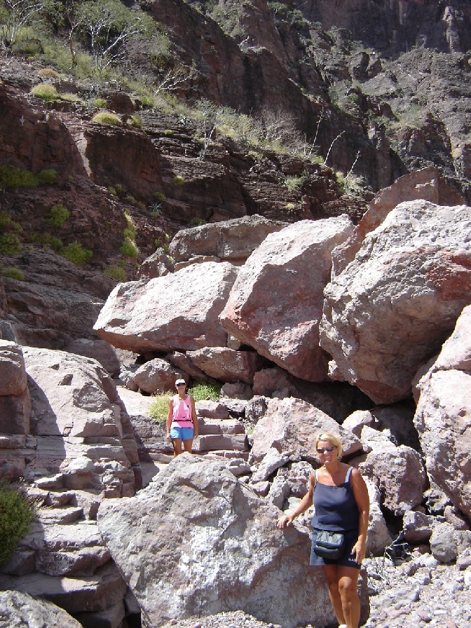
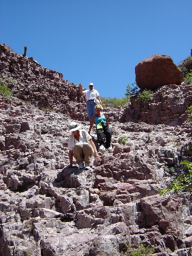
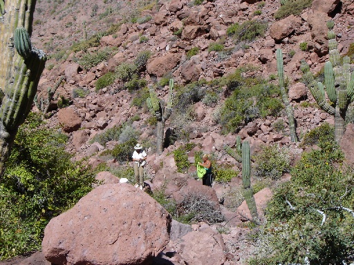
Our second day we took a hike with Dave and Debbie from Megabyte and Mike and Kay from Finisterre. The hike was up an arroyo (dry river bed) which ended in an incredible box canyon. At the head of the canyon shear rock walls rose to about 800 ft. We could see several waterfalls, all dry, cascading down from the heights. We tried hiking into the head of the canyon as far as we could, with Linda taking the lead while the rest stopped to take a few pictures. Linda got just out of sight around a few boulders when we heard a shout followed by Linda hopping back down the rocks yelling "Rattle! Rattle!". She must have disturbed a rattlesnake in the boulders. She never saw it but heard it clearly enough, as had Debbie. Dave and I took a careful look into the area but neither of us saw or heard anything. Linda must have scared the poor thing. After that we were extra careful and made sure to throw a rock or two and/or shout as we made our way around the rocks.
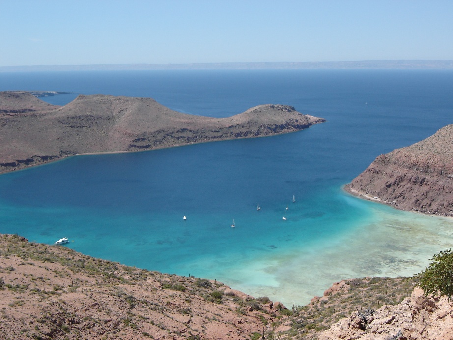
Today we are moving back to La Paz, first stop Isla San Francisco. I can't wait to post pictures of this incredible desert island. The cove is beautiful and the water is swimming pool clear with a perfect crescent shaped white sand beach. Mexico Rev 2 is pretty nice!
John and Linda
Monday, April 11, 2005
Mega hike with Megabyte
April 10, 2005
San Evaristo, Baja California del Sur (24o 55' N, 110o 42'W)
This morning we slept in late (0730) after a windy and chilly night. We didn't have any problems with dragging anchor or anything, it was just noisy and cold (63 degrees in the cabin this morning). I'll need to get another blanket out from under the quarter berth if this keeps up. We had meant to meet up with Dave and Debbie on Megabyte at 0830 but with the late start we pushed it back to 0900 so that we could have our morning coffee and some breakfast before starting out on the big hike we'd planned.
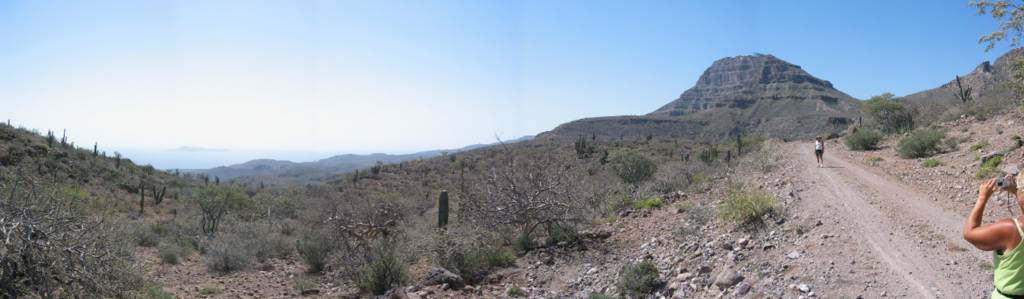
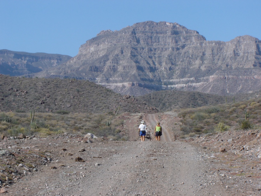
We landed our dinghies on the beach (no surf landings to worry about so far here in Baja) and set off on a very primitive dirt road. A road sign (kind of the last thing you expect to see out in the middle of nowhere) told us that it was 11 kilometers from the beach village of San Evaristo to the mountain village of El Bosque, and we knew from our cruising guides that the road continued on out from there to the La Paz highway. We didn't expect to make it the whole way since we were climbing up into the mountains via small canyons and ridges, but at least it was a road. In fact there were a couple of signs tacked to trees pointing the way for the "Dos Mares 500" and along the way we were passed by two dirt bikes, a Jeep, and a Chevy Blazer all climbing fast and throwing out lots of dust. We walked for two hours and, according to Dave's pedometer, we covered about five miles. We figured that was a good goal so we stopped for lunch and then headed back.
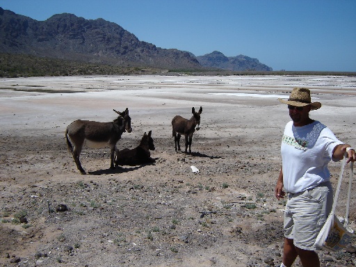
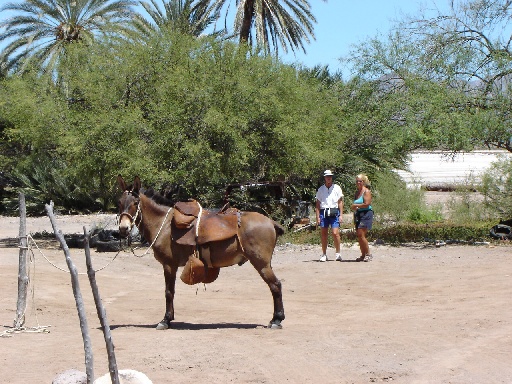
During ourreturn when we were almost back at San Evaristo we were passed by a truck carrying cows and when we reached the beach we saw a pen full of goats. This was a lot of livestock considering all we saw on our tour of the town yesterday were burros (including a baby burrito), or maybe they were mules, we're not sure how to tell yet. There was also a goat in a panga that looked like he was being given a time out. Don't know why he didn't get to go ashore with the rest of the goats on the beach. Well, later, after I'd taken my shower and John was just getting his, Dave called on the radio to alert us to the latest village news. I got out the binoculars just in time to catch four men loading the first of three young cows into a panga! They got the first one down into the bottom of the boat, but the second was the biggest and he was having none of it. He ran down the beach and the rope slipped out of his keeper's hands. Since all the men and the boats were on the beach I guess he figured the water looked like the safest place so he plunged in and I thought he was going to swim out to Nakia. But they got the panga launched in time to head him back into the beach and finally convinced him to jump in the boat.
In the meantime all the penned goats had been loaded into the truck that had brought the cows, and were bound for who knows where. They got the third (smallest) cow loaded in the panga (with the last two cows standing up) and, with engines roaring and hearty waves of thanks to the two guys left on shore, took off into the wind and chop. Well, they didn't make it half way out of the bay before they almost tipped their overloaded boat and cut the engine. One of their friends roared out in his panga and came alongside the cow carrier. There was a long discussion (no doubt concerning proper load placement and boat handling when carrying cows) before he left them to continue on their way. This time they went slowly and stayed close to shore before heading out of sight (and straight into the wind) around the corner of the point. We are rooting that the cows made it safely to their new home, and will be filing our report to PETA when we return to La Paz.
We had planned on continuing north to Agua Verde tomorrow, but will most likely remain hunkered down here for another day waiting for the wind to die down or change to a favorable sailing direction.
Linda (writing the blog this time) and John
Saturday, April 02, 2005
Welcome to Mexico, Rev 2
La Paz, Baja California del Sur
April 2, 2005
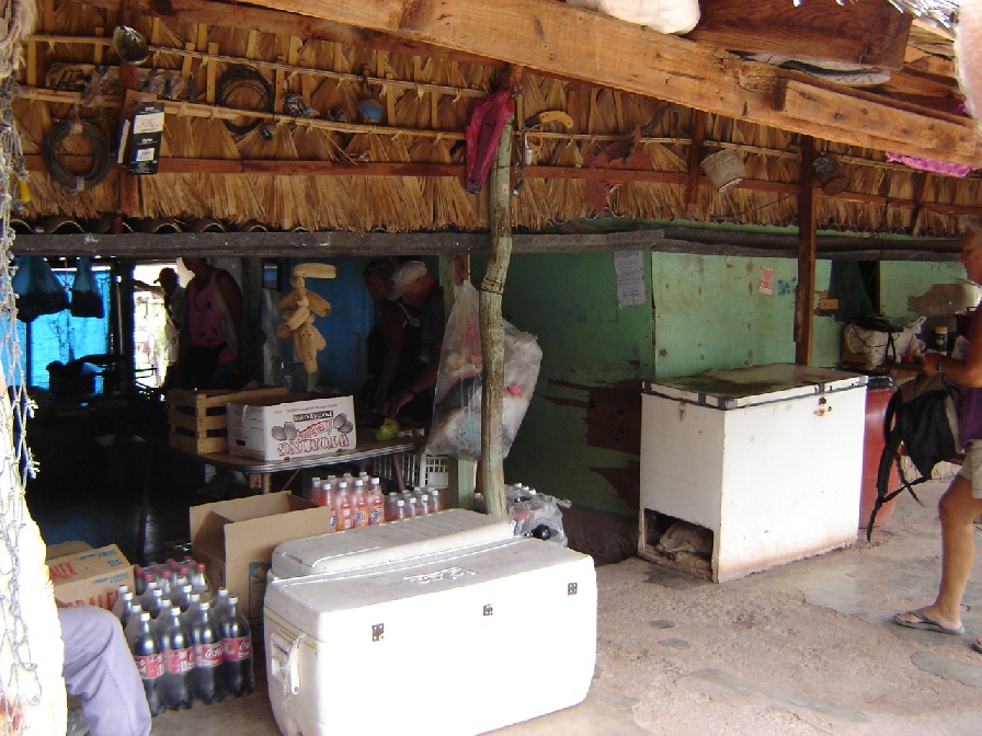
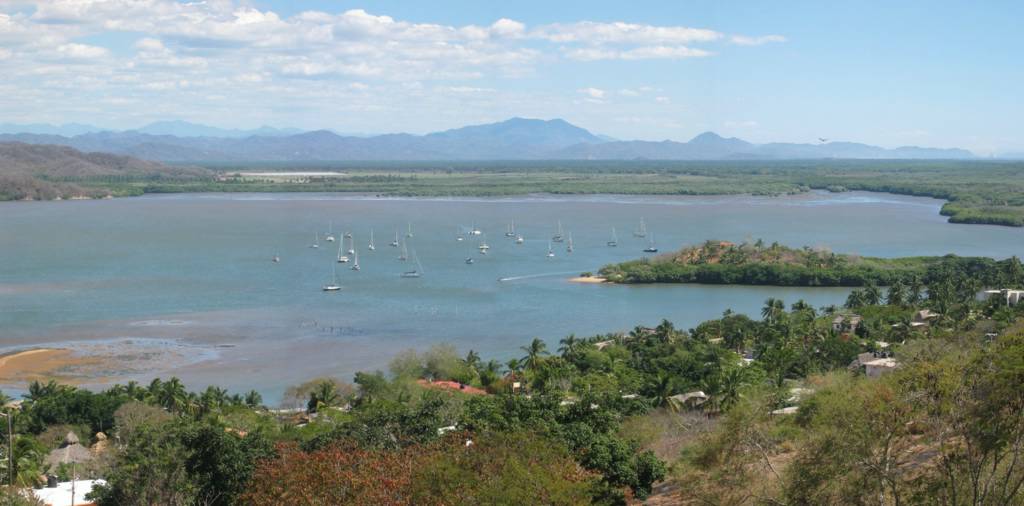
We arrived in La Paz right on schedule and tied up in a slip at Marina de La Paz. As usual, since we're in a marina, we immediately set to work knocking items off our 'to do' list. We went shopping, walked around town to get the lay of the land and even got fitted for full lycra dive suits which we'll use this summer in the Sea of Cortez as protection from stinging jelly fish.
As we walked around town it became obvious that Baja Mexico is far different from mainland Mexico. It seems like more people own cars, there's more traffic. The sidewalks are in better shape then mainland Mexico. The air is very dry, being desert country, and not humid like the mainland. The water is clearer and it gets colder at night.
The best part, from my point of view, is freshly made flour tortillas. The food in Mexico is very regional, in some areas it seems everyone is selling a specific dish and 100 miles away it's rarely offered. This is the way it is with flour tortillas, they are more popular in the north which means in the south you can only get factory made flour tortillas. La Paz is the first place we've found where flour tortillas are made at the tortillaria along with corn tortillas. There is _nothing_ like a flour tortilla hot off the griddle!
Our marina stay is almost up. We bought five nights just to get some errands done, and then we'll be moving out to the islands. We'll return to La Paz by the 18th. Then we'll travel by bus from La Paz to the States via Tijuana (20 hours, plus walking across the border to catch the trolley into San Diego) to renew our tourist visas and make some needed purchases. Sound's like fun, doesn't it?
John and Linda
April 2, 2005
We arrived in La Paz right on schedule and tied up in a slip at Marina de La Paz. As usual, since we're in a marina, we immediately set to work knocking items off our 'to do' list. We went shopping, walked around town to get the lay of the land and even got fitted for full lycra dive suits which we'll use this summer in the Sea of Cortez as protection from stinging jelly fish.
As we walked around town it became obvious that Baja Mexico is far different from mainland Mexico. It seems like more people own cars, there's more traffic. The sidewalks are in better shape then mainland Mexico. The air is very dry, being desert country, and not humid like the mainland. The water is clearer and it gets colder at night.
The best part, from my point of view, is freshly made flour tortillas. The food in Mexico is very regional, in some areas it seems everyone is selling a specific dish and 100 miles away it's rarely offered. This is the way it is with flour tortillas, they are more popular in the north which means in the south you can only get factory made flour tortillas. La Paz is the first place we've found where flour tortillas are made at the tortillaria along with corn tortillas. There is _nothing_ like a flour tortilla hot off the griddle!
Our marina stay is almost up. We bought five nights just to get some errands done, and then we'll be moving out to the islands. We'll return to La Paz by the 18th. Then we'll travel by bus from La Paz to the States via Tijuana (20 hours, plus walking across the border to catch the trolley into San Diego) to renew our tourist visas and make some needed purchases. Sound's like fun, doesn't it?
John and Linda
Subscribe to:
Posts (Atom)